GeotchaA geography quiz on a real globe
Largest city of each country
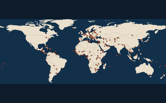
189 cities, each one drawn on a satellite globe. Name it when it lights up, find it when you are given its name, tell its flag from three others, or type every one you can remember in Name all.
Free to start: a few quizzes a day cost nothing, and Geotcha Plus opens every quiz. What you miss comes back for review until it sticks.
The full list
About this quiz
Shanghai is the largest of the 189 cities in this quiz, at 42.3 M; Vatican City is the smallest listed, at 1 k. The three largest hold 13% of the combined population of all 189.
What they are known for
- Shanghai: Includes Changshu, Changzhou, Suzhou, Wuxi.
- Tokyo: Includes Chiba, Kawasaki, Maebashi, Sagamihara, Saitama, Utsunomiya, Yokohama.
- Delhi: Includes Faridabad, Ghaziabad, Gurugram.
- Jakarta: Includes Bekasi, Bogor, Depok, South Tangerang, Tangerang.
- Manila: Includes Caloocan, Quezon City.
- Mexico City: Includes Ciudad Nezahualcóyotl, Ecatepec de Morelos, Naucalpan de Juárez.
- Seoul: Includes Bucheon, Goyang, Incheon, Seongnam, Suwon.
- Cairo: Includes Giza, Shubra El Kheima.
The cities
- 1Shanghai China42.3 M
- 2Tokyo Japan41.3 M
- 3Delhi India36.9 M
- 4Jakarta Indonesia29.8 M
- 5Manila Philippines27.1 M
- 6Mexico City Mexico25.6 M
- 7Seoul South Korea25.4 M
- 8Dhaka Bangladesh23.7 M
- 9Cairo Egypt23.2 M
- 10São Paulo Brazil22.7 M
- 11New York City United States22.6 M
- 12Bangkok Thailand22.4 M
- 13Lagos Nigeria21.9 M
- 14Karachi Pakistan21.8 M
- 15Moscow Russia19.1 M
- 16Tehran Iran17.2 M
- 17Buenos Aires Argentina17 M
- 18Kinshasa Democratic Republic of the Congo16.9 M
- 19Istanbul Turkey16.2 M
- 20London United Kingdom15.4 M
- 21Johannesburg South Africa15.1 M
- 22Ho Chi Minh City Vietnam14.7 M
- 23Lima Peru12.2 M
- 24Paris France11.6 M
- 25Bogotá Colombia10.8 M
- 26Luanda Angola10.4 M
- 27Taipei Taiwan10.2 M
- 28Kuala Lumpur Malaysia9.8 M
- 29Santiago Chile8.6 M
- 30Toronto Canada8.3 M
- 31Singapore8.2 M
- 32Baghdad Iraq8 M
- 33Riyadh Saudi Arabia7.9 M
- 34Khartoum Sudan7.4 M
- 35Abidjan Côte d'Ivoire7.3 M
- 36Nairobi Kenya7.2 M
- 37Accra Ghana7.1 M
- 38Madrid Spain7 M
- 39Dar es Salaam Tanzania6.9 M
- 40Dubai United Arab Emirates6.7 M
- 41Milan Italy6.6 M
- 42Amman Jordan6.3 M
- 43Bamako Mali6 M
- 44Kabul Afghanistan5.5 M
- 45Melbourne Australia5.5 M
- 46Kampala Uganda5.4 M
- 47Colombo Sri Lanka5 M
- 48Addis Ababa Ethiopia5 M
- 49Yangon Myanmar4.9 M
- 50Berlin Germany4.7 M
- 51Casablanca Morocco4.5 M
- 52Algiers Algeria4.4 M
- 53Dakar Senegal4.4 M
- 54Tashkent Uzbekistan4.1 M
- 55Damascus Syria4.1 M
- 56Conakry Guinea4 M
- 57Douala Cameroon4 M
- 58Santo Domingo Dominican Republic4 M
- 59Caracas Venezuela3.9 M
- 60Baku Azerbaijan3.7 M
and 129 more, all in the quiz.
On the map
More of the world
- Largest city of each 10° band of latitude
- Largest country on each continent
- Most populous region of each country, top 100
- Highest peak of each country
- Largest lake on each continent
- Longest river on each continent
- Largest island on each continent
- Largest city of each 30° band of longitude
- Most populous country on each continent
- Highest peak on each continent
Similar quizzes
- Largest city of each state of the United States
- Largest city of each region of India
- Largest city of each state of Brazil
- Largest city of each region of China
- Largest city of each state of Germany
- Largest city of each prefecture of Japan
- Largest city of each region of Italy
- Largest city of each region of Russia
The whole world
How the figures are measured
Population of the metro area: the city and the places continuously built up around it, as Thomas Brinkhoff’s Major Agglomerations of the World (citypopulation.de) counts them from censuses projected to 1 January 2026, the list most rankings use. It covers every agglomeration of 1 million or more; below that, a city ranks by its urban centre in the United Nations’ World Urbanization Prospects 2025 at 1 January 2026 (every city of 300,000 or more and every capital, counted by the Degree of Urbanisation on a 1 km grid), and a smaller city by its city-proper figure. Each source agglomeration is counted once: its main city and named core cities are accepted answers for the same entry. The included core cities are listed on its card. These agglomerations are not official US metropolitan statistical areas. Cities of the polycentric regions excluded from this source list still rank by their own figures. One per group: the largest city of each country by this measure, then ranked together.