GeotchaA geography quiz on a real globe
Districts of Czechia
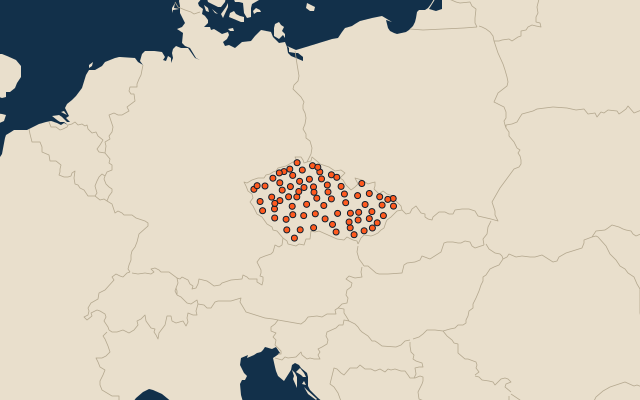
77 districts, each one drawn on a satellite globe. Name it when it lights up, find it when you are given its name, or type every one you can remember in Name all.
Free to play, with no account needed. What you miss comes back for review until it sticks.
The districts
- 1Jindřichův Hradec District1,944 km²
- 2Klatovy District1,940 km²
- 3Znojmo District1,637 km²
- 4Karlovy Vary District1,628 km²
- 5Příbram District1,628 km²
- 6České Budějovice District1,626 km²
- 7Olomouc District1,618 km²
- 8Český Krumlov District1,615 km²
- 9Žďár nad Sázavou District1,552 km²
- 10Bruntál District1,549 km²
- 11Benešov District1,528 km²
- 12Třebíč District1,509 km²
- 13Tachov District1,379 km²
- 14Prachatice District1,375 km²
- 15Svitavy District1,335 km²
- 16Tábor District1,327 km²
- 17Šumperk District1,316 km²
- 18Plzeň-North District1,314 km²
- 19Pelhřimov District1,290 km²
- 20Frýdek-Místek District1,273 km²
- 21Havlíčkův Brod District1,265 km²
- 22Ústí nad Orlicí District1,265 km²
- 23Brno-Country District1,238 km²
- 24Jihlava District1,180 km²
- 25Břeclav District1,174 km²
- 26Plzeň-South District1,147 km²
- 27Trutnov District1,147 km²
- 28Písek District1,138 km²
- 29Česká Lípa District1,137 km²
- 30Vsetín District1,131 km²
- 31Opava District1,126 km²
- 32Louny District1,118 km²
- 33Hodonín District1,086 km²
- 34Domažlice District1,069 km²
- 35Mladá Boleslav District1,058 km²
- 36Zlín District1,040 km²
- 37Litoměřice District1,032 km²
- 38Strakonice District1,032 km²
- 39Chrudim District1,030 km²
- 40Rychnov nad Kněžnou District998 km²
- 41Uherské Hradiště District991 km²
- 42Blansko District942 km²
- 43Chomutov District935 km²
- 44Cheb District933 km²
- 45Rakovník District930 km²
- 46Liberec District925 km²
- 47Nový Jičín District918 km²
- 48Kutná Hora District917 km²
- 49Děčín District909 km²
- 50Pardubice District889 km²
- 51Vyškov District889 km²
- 52Jičín District887 km²
- 53Hradec Králové District876 km²
- 54Nymburk District872 km²
- 55Náchod District852 km²
- 56Kolín District850 km²
- 57Přerov District845 km²
- 58Kroměříž District799 km²
- 59Prostějov District770 km²
- 60Sokolov District754 km²
and 17 more, all in the quiz.
Second-level units: the 77 districts, within the 14 regions (the first level), which the region hint names. Area in km²: Wikidata’s figure (P2046, the whole or the land area, whichever matches the outline) where it is within a factor of two of the outline’s area; the official area where the national statistics office gives one (countries whose divisions changed since Natural Earth). Each item names its source. Sources: OpenStreetMap (ODbL), Wikidata (CC0), national statistics offices.
On the map
More in Czechia
- 25 largest cities in Czechia
- Regions of Czechia
- 17 longest rivers in Czechia
- 25 highest peaks in Czechia
- Flags of the regions of Czechia
- 10 largest cities in Czechia
- 10 most populous regions of Czechia
- Cities ranked 26–50 in Czechia
- 25 most populous districts of Czechia
- Regional capitals of Czechia
Similar quizzes
- States of the United States
- 10 most populous states of the United States
- Counties of the United States
- 25 most populous counties of the United States
- States of India
- 10 most populous states of India
- Districts of India
- 25 most populous districts of India
- States and the federal district of Brazil
- 10 most populous states and the federal district of Brazil
- US states