GeotchaA geography quiz on a real globe
Counties of Poland
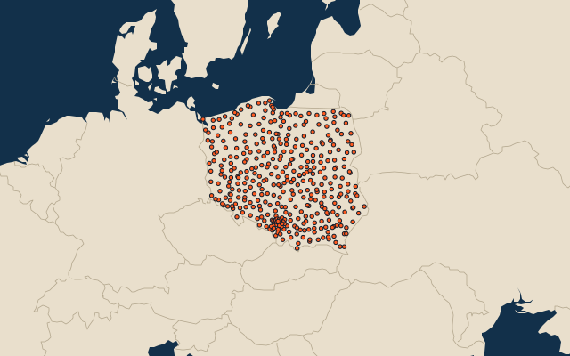
380 counties, each one drawn on a satellite globe. Name it when it lights up, find it when you are given its name, or type every one you can remember in Name all.
Free to play, with no account needed. What you miss comes back for review until it sticks.
The counties
- 1Białystok County2,977 km²
- 2Olsztyn County2,838 km²
- 3Biała Podlaska County2,754 km²
- 4Słupsk County2,295 km²
- 5Kielce County2,246 km²
- 6Bytów County2,192 km²
- 7Ostrołęka County2,094 km²
- 8Sokółka County2,054 km²
- 9Szczytno County1,933 km²
- 10Poznań County1,900 km²
- 11Chełm County1,881 km²
- 12Zamość County1,870 km²
- 13Gryfino County1,869 km²
- 14Czarnków-Trzcianka County1,808 km²
- 15Płock County1,797 km²
- 16Pisz County1,775 km²
- 17Ostróda County1,767 km²
- 18Szczecinek County1,766 km²
- 19Drawsko County1,764 km²
- 20Biłgoraj County1,681 km²
- 21Lublin County1,680 km²
- 22Złotów County1,661 km²
- 23Augustów County1,659 km²
- 24Koszalin County1,646 km²
- 25Kłodzko County1,643 km²
- 26Hajnówka County1,624 km²
- 27Siedlce County1,603 km²
- 28Konin County1,578 km²
- 29Człuchów County1,575 km²
- 30Nowy Sącz County1,550 km²
- 31Opole County1,534 km²
- 32Radom County1,530 km²
- 33Częstochowa County1,522 km²
- 34Goleniów County1,521 km²
- 35Stargard County1,520 km²
- 36Sieradz County1,491 km²
- 37Tomaszów Lubelski County1,487 km²
- 38Nowy Targ County1,475 km²
- 39Świecie County1,474 km²
- 40Włocławek County1,472 km²
- 41Siemiatycze County1,459 km²
- 42Radomsko County1,443 km²
- 43Piotrków County1,428 km²
- 44Wałcz County1,415 km²
- 45Tarnów County1,412 km²
- 46Bydgoszcz County1,394 km²
- 47Łuków County1,394 km²
- 48Żary County1,393 km²
- 49Krosno Odrzańskie County1,390 km²
- 50Międzyrzecz County1,388 km²
- 51Bielsk County1,385 km²
- 52Iława County1,385 km²
- 53Mońki County1,382 km²
- 54Płońsk County1,380 km²
- 55Chojnice County1,364 km²
- 56Łomża County1,355 km²
- 57Zielona Góra County1,351 km²
- 58Starogard County1,346 km²
- 59Choszczno County1,328 km²
- 60Elbląg County1,316 km²
and 320 more, all in the quiz.
Second-level units: the 380 counties, within the 16 voivodeships (the first level), which the region hint names. Area in km²: the official area where the national statistics office gives one (countries whose divisions changed since Natural Earth). Each item names its source. Sources: OpenStreetMap (ODbL), national statistics offices.
On the map
More in Poland
- 25 largest cities in Poland
- Voivodeships of Poland
- 6 largest lakes in Poland
- 25 longest rivers in Poland
- 25 highest peaks in Poland
- 6 largest islands in Poland
- Flags of the voivodeships of Poland
- 10 largest cities in Poland
- 10 most populous voivodeships of Poland
- Cities ranked 26–50 in Poland
Similar quizzes
- States of the United States
- 10 most populous states of the United States
- Counties of the United States
- 25 most populous counties of the United States
- States of India
- 10 most populous states of India
- Districts of India
- 25 most populous districts of India
- States and the federal district of Brazil
- 10 most populous states and the federal district of Brazil
- US states