GeotchaA geography quiz on a real globe
8 most populous regions of Iceland
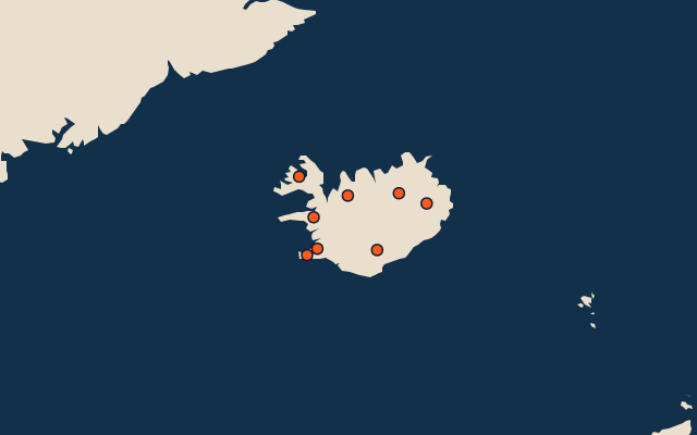
8 regions, each one drawn on a satellite globe. Name it when it lights up, find it when you are given its name, or type every one you can remember in Name all.
Free to start: a few quizzes a day cost nothing, and Geotcha Plus opens every quiz. What you miss comes back for review until it sticks.
The full list
About this quiz
Capital Region is the largest of the 8 regions in this quiz, at 252 k; Westfjords is the smallest listed, at 7 k. Capital Region's population is 6.8 times Southern's (37 k). The three largest hold 81% of the combined population of all 8.
What they are known for
- Capital Region: Hallgrímskirkja, Harpa concert hall and a harbour facing Faxaflói bay mark the national seat of government.
- Southern: Þingvellir, Geysir and Gullfoss form a celebrated touring route; black-sand beaches line the coast.
- Northeastern: Akureyri stands at the head of a long fjord; Mývatn has volcanic craters and Húsavík offers whale watching.
- Southern Peninsula: Keflavík airport, the Blue Lagoon and volcanic lava fields occupy the country’s southwestern peninsula.
- Western: Snæfellsjökull crowns a glacier-capped volcano; Borgarnes and Reykholt recall medieval sagas.
- Eastern: Seyðisfjörður has colourful wooden houses; Egilsstaðir lies near Hallormsstaður’s woodland and Lagarfljót.
- Northwestern: Skagafjörður has horse farms and the turf houses of Glaumbær; Hvítserkur rises from coastal shallows.
- Westfjords: Ísafjörður faces steep fjords; Dynjandi cascades down a wide rock face near remote coastal roads.
The regions
- 1Capital Region252 k
- 2Southern37 k
- 3Northeastern32 k
- 4Southern Peninsula30 k
- 5Western18 k
- 6Eastern11 k
- 7Northwestern7 k
- 8Westfjords7 k
On the map
All of Europe
More in Iceland
- Regional capitals of Iceland
- Regions of Iceland
- 6 longest rivers in Iceland
- 25 highest peaks in Iceland
- 18 largest islands in Iceland
- 25 longest fjords in Iceland
- 11 largest glaciers in Iceland by area
- 10 best known waterfalls in Iceland
Other countries of Europe
- States of Germany
- 10 most populous states of Germany
- Districts of Germany
- 25 most populous districts of Germany
- Regions of Italy
- 10 most populous regions of Italy
- Provinces of Italy
- 25 most populous provinces of Italy
How the figures are measured
Population of each region: for countries whose divisions changed since Natural Earth, the figure of the national statistics office, as each item names it. Each item names its source and year. Regions without a figure are left out.