GeotchaA geography quiz on a real globe
25 longest rivers in Indonesia
25 rivers, each one drawn on a satellite globe. Name it when it lights up, find it when you are given its name, or type every one you can remember in Name all.
Free to start: a few quizzes a day cost nothing, and Geotcha Plus opens every quiz. What you miss comes back for review until it sticks.
The full list
About this quiz
The Kapuas is the longest of the 25 rivers in this quiz, at 1,143 km; the Taritatu is the shortest listed, at 320 km. Indonesia has 23 of the 25, in a list that spans two countries.
What they are known for
- Kapuas: Borneo's great river, reaching the sea at Pontianak on the equator
- Sepik: Papua New Guinea river famous for its carved spirit houses and crocodile rites
- Fly: Flows through Papua New Guinea's swamps to the Gulf of Papua
- Mahakam: Flows into the Makassar Strait
- Barito: Flows into the Java Sea
- Batang Hari: Flows into the South China Sea
- Pulau: Flows into the Arafura Sea
- Kahayan: Flows into the Java Sea
The rivers
- 1Kapuas Indonesia1,143 km
- 2Sepik Papua New Guinea1,126 km
- 3Fly Papua New Guinea1,050 km
- 4Mahakam Indonesia940 km
- 5Barito Indonesia900 km
- 6Batang Hari Indonesia800 km
- 7Pulau Indonesia674 km
- 8Kahayan Indonesia658 km
- 9Katingan Indonesia650 km
- 10Digul Indonesia600 km
- 11Kapuas (Barito River tributary) Indonesia600 km
- 12Rokan Indonesia600 km
- 13Kayan Indonesia576 km
- 14Kayan (North Kalimantan) Indonesia576 km
- 15Bengawan Solo Indonesia548 km
- 16Musi Indonesia500 km
- 17Barumun Indonesia440 km
- 18Kampar Indonesia414 km
- 19Mentaya Indonesia400 km
- 20Seruyan Indonesia350 km
- 21Sungai Hong Indonesia345 km
- 22Teweh Indonesia330 km
- 23Bahau Indonesia320 km
- 24Brantas Indonesia320 km
- 25Taritatu Indonesia320 km
On the map
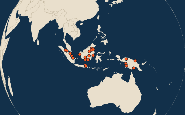
All of Asia
More in Indonesia
- 25 largest cities in Indonesia
- Provinces of Indonesia
- 25 highest peaks in Indonesia
- 25 largest islands in Indonesia
- 10 best known World Heritage Sites in Indonesia
- Flags of the provinces of Indonesia
- 10 largest cities in Indonesia
- 10 most populous provinces of Indonesia
- Cities ranked 26–50 in Indonesia
- Regencies and cities of Indonesia
In the regions of Indonesia
Other countries of Asia
- 25 longest rivers in India
- 25 longest rivers in China
- 25 longest rivers in Japan
- 7 longest rivers in the Philippines
- 22 longest rivers in Pakistan
- 25 longest rivers in Turkey
- 25 longest rivers in Iran
- 12 longest rivers in Malaysia
The whole world
How the figures are measured
Length in km as Wikidata records it (P2043, the best-ranked figure). Each named river counts on its own: the river that carries the name, from its source to its mouth. Headstreams and tributaries with names of their own are rivers of their own, so the Missouri and the Mississippi are two rivers here, as are the Irtysh and the Ob (the Longest River Systems set measures such chains as one system, from the most distant source). A named section of a river is that river: the Solimões, as the Amazon’s upper course is called in Brazil, is the Amazon. Where the recorded length runs from a differently named headwater (the Congo’s from the Lualaba’s source), the course is drawn on up that headwater. Rivers under 200 km are in only when they are well known (30 or more Wikipedia editions), and a river whose mapped course covers under half its recorded length is left out.