GeotchaA geography quiz on a real globe
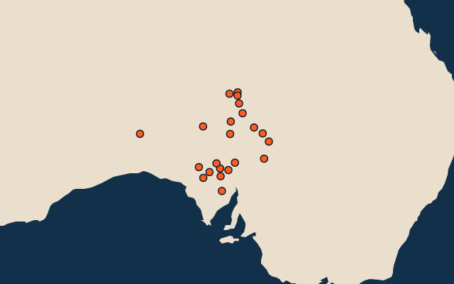
22 largest lakes in South Australia
22 lakes, each one drawn on a satellite globe. Name it when it lights up, find it when you are given its name, or type every one you can remember in Name all.
Free to play, with no account needed. What you miss comes back for review until it sticks.
The lakes
- 1Lake Eyre North8,144 km²
- 2Lake Torrens5,700 km²
- 3Lake Gairdner4,350 km²
- 4Lake Frome2,596 km²
- 5Lake Eyre South1,280 km²
- 6Lake Everard1,267 km²
- 7Island Lagoon798 km²
- 8Peera Peera Poolanna Lake501 km²
- 9Lake MacFarlane474 km²
- 10Lake Griselda348 km²
- 11Lake Acraman308 km²
- 12Lake Cadibarrawirracanna300 km²
- 13Lake Gregory300 km²
- 14Lake Umaroona263 km²
- 15Lake Gilles217 km²
- 16Pernatty Lagoon180 km²
- 17Lake Blanche170 km²
- 18Lake Callabonna160 km²
- 19Lake Warrandirinna160 km²
- 20Lake Hart150 km²
- 21Lake Dey Dey122 km²
- 22Lake Mulapula114 km²
Surface area in km²: the Largest Lakes set’s figure for its lakes, else Wikidata’s (P2046) where it fits the outline, else the area of the outline. Seasonal salt pans keep their recorded figure; their area varies. Every named lake Natural Earth maps at 1:10m (with its supplements for Europe, North America and Australia), and every lake of the Largest Lakes set. The Caspian Sea counts as a lake, as in that set; coastal lagoons (the Vistula Lagoon, the Black Sea limans) do not. Countries are those on its shores, from the outlines. Natural lakes only: reservoirs (artificial lakes behind a dam, as Natural Earth or Wikidata mark them) are left out. An item counts for every first-level unit (state, province, county) it touches: a lake or island by its outline, a river by its course, within about 1.5 km; a summit, a cape or anything without a shape by its point.
On the map
More in South Australia
Similar quizzes
- 9 largest lakes in New South Wales
- 6 largest lakes in Northern Territory
- 25 largest lakes in Western Australia
- 25 largest lakes in Alberta
- 25 largest lakes in British Columbia
- 25 largest lakes in Manitoba
- 24 largest lakes in Newfoundland and Labrador
- 25 largest lakes in Ontario
- 25 largest lakes in Quebec
- 25 largest lakes in Saskatchewan
- Largest lakes