GeotchaA geography quiz on a real globe
17 longest rivers in Uzbekistan
17 rivers, each one drawn on a satellite globe. Name it when it lights up, find it when you are given its name, or type every one you can remember in Name all.
Free to start: a few quizzes a day cost nothing, and Geotcha Plus opens every quiz. What you miss comes back for review until it sticks.
The full list
About this quiz
The Amu Darya is the longest of the 17 rivers in this quiz, at 2,620 km; the Akbulak is the shortest listed, at 40 km. They lie in five countries; Uzbekistan has the most, with eight.
What they are known for
- Amu Darya: Rises in the Pamirs on the Afghan border and once fed the southern Aral Sea; Alexander the Great crossed it.
- Syr Darya: Rises in Kyrgyzstan's Tian Shan, waters the Fergana Valley and ends in the small northern remnant of the Aral Sea.
- Zeravshan: Waters the Samarkand and Bukhara oases of the old Silk Road
- Naryn: Kyrgyz river, dammed at Toktogul, that joins the Kara Darya to form the Syr Darya
- Kofarnihon: Flows into the Amu Darya
- Keles: Flows into the Syr Darya
- Angren: Flows into the Syr Darya
- Chatkal: Flows into the Chirchiq
The rivers
- 1Amu Darya Turkmenistan2,620 km
- 2Syr Darya Kazakhstan2,212 km
- 3Zeravshan Uzbekistan877 km
- 4Naryn Kyrgyzstan807 km
- 5Kofarnihon Tajikistan387 km
- 6Qashqadaryo Uzbekistan378 km
- 7Keles Kazakhstan241 km
- 8Angren Uzbekistan236 km
- 9Chatkal Kyrgyzstan217 km
- 10Kara Darya Uzbekistan180 km
- 11Chirchiq Uzbekistan154 km
- 12Ak-Buura Kyrgyzstan148 km
- 13Kosonsoy Uzbekistan127 km
- 14Isfayramsay Kyrgyzstan122 km
- 15Jazy Kyrgyzstan122 km
- 16Aravan Uzbekistan102 km
- 17Akbulak Uzbekistan40 km
On the map
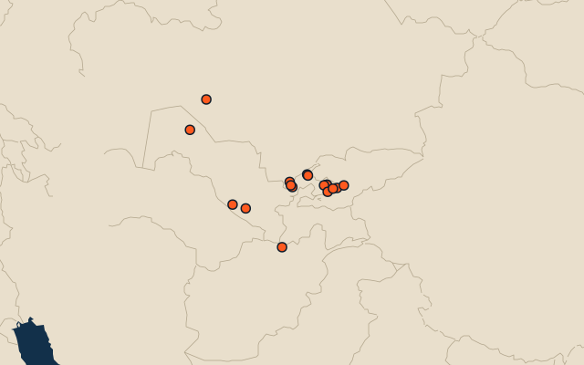
All of Asia
More in Uzbekistan
- 25 largest cities in Uzbekistan
- Regions, the autonomous republic and the city of Uzbekistan
- 8 best known World Heritage Sites in Uzbekistan
- 10 largest cities in Uzbekistan
- 10 most populous regions, the autonomous republic and the city of Uzbekistan
- Regional capitals of Uzbekistan
- Cities over 100,000 in Uzbekistan
In the regions of Uzbekistan
Other countries of Asia
- 25 longest rivers in India
- 25 longest rivers in China
- 25 longest rivers in Japan
- 25 longest rivers in Indonesia
- 7 longest rivers in the Philippines
- 22 longest rivers in Pakistan
- 25 longest rivers in Turkey
- 25 longest rivers in Iran
The whole world
How the figures are measured
Length in km as Wikidata records it (P2043, the best-ranked figure). Each named river counts on its own: the river that carries the name, from its source to its mouth. Headstreams and tributaries with names of their own are rivers of their own, so the Missouri and the Mississippi are two rivers here, as are the Irtysh and the Ob (the Longest River Systems set measures such chains as one system, from the most distant source). A named section of a river is that river: the Solimões, as the Amazon’s upper course is called in Brazil, is the Amazon. Where the recorded length runs from a differently named headwater (the Congo’s from the Lualaba’s source), the course is drawn on up that headwater. Rivers under 200 km are in only when they are well known (30 or more Wikipedia editions), and a river whose mapped course covers under half its recorded length is left out.