GeotchaA geography quiz on a real globe
10 most populous regions and the autonomous monastic state of Greece
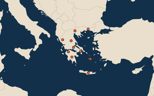
10 regions and the autonomous monastic state, each one drawn on a satellite globe. Name it when it lights up, find it when you are given its name, or type every one you can remember in Name all.
Free to start: a few quizzes a day cost nothing, and Geotcha Plus opens every quiz. What you miss comes back for review until it sticks.
The full list
About this quiz
Attica is the largest of the 10 regions and the autonomous monastic state in this quiz, at 3.8 M; Epirus is the smallest listed, at 318 k. Attica's population is about twice Centre Macedonia's (1.8 M). The three largest hold 64% of the combined population of all 10.
What they are known for
- Attica: The Acropolis and Parthenon, Athens, Piraeus port and Sounion's temple of Poseidon.
- Centre Macedonia: Thessaloniki's White Tower, the Halkidiki beaches, Mount Olympus' foothills and Vergina royal tombs.
- Thessalia: Plains of the Meteora cliff monasteries, Mount Olympus' southern slopes and Pelion's villages.
- West Greece: Olympia, birthplace of the Games, Patras carnival, the Rio-Antirrio bridge and Missolonghi's lagoon.
- Crete: Largest Greek island: Minoan Knossos palace, Samaria Gorge, Chania, Heraklion and raki.
- East Macedonia and Thrace: Northeast corner with Kavala, Thasos island, Xanthi and the Turkish border by Evros river.
- Peloponnese: Ancient Sparta, Mycenae's Lion Gate, Epidaurus theatre, the Corinth Canal and Mani towers.
- Central Greece: Delphi's oracle, Thermopylae battlefield, Parnassos ski slopes and the island of Euboea.
The regions and the autonomous monastic state
- 1Attica3.8 M
- 2Centre Macedonia1.8 M
- 3Thessalia707 k
- 4West Greece644 k
- 5Crete590 k
- 6East Macedonia and Thrace559 k
- 7Peloponnese536 k
- 8Central Greece505 k
- 9South Aegean326 k
- 10Epirus318 k
On the map
All of Europe
More in Greece
- 25 largest cities in Greece
- Regions and the autonomous monastic state of Greece
- 12 largest lakes in Greece
- 13 longest rivers in Greece
- 25 highest peaks in Greece
- 25 largest islands in Greece
- 7 best known canyons and gorges in Greece
- 10 largest cities in Greece
- 20 best known World Heritage Sites in Greece
- Cities ranked 26–50 in Greece
Other countries of Europe
- States of Germany
- 10 most populous states of Germany
- Districts of Germany
- 25 most populous districts of Germany
- Regions of Italy
- 10 most populous regions of Italy
- Provinces of Italy
- 25 most populous provinces of Italy
How the figures are measured
Population of each region: a 2025 estimate: the latest official figure (a census or an estimate, as each item names it) scaled with the rest of its country’s regions to the World Bank’s 2025 national total, so a country’s regions share one year. Each item names its source and year. Regions without a figure are left out.