GeotchaA geography quiz on a real globe
10 most populous cantons of Switzerland
10 cantons, each one drawn on a satellite globe. Name it when it lights up, find it when you are given its name, tell its flag from three others, or type every one you can remember in Name all.
Free to start: a few quizzes a day cost nothing, and Geotcha Plus opens every quiz. What you miss comes back for review until it sticks.
The full list
About this quiz
Zürich is the largest of the 10 cantons in this quiz, at 1.6 M; Fribourg is the smallest listed, at 346 k. Zürich's population is 1.5 times Bern's (1.1 M). The three largest hold 52% of the combined population of all 10.
What they are known for
- Zürich: Switzerland's financial centre, banks, FIFA headquarters, a big lake and the Bahnhofstrasse.
- Bern: Federal city seat of government, with medieval arcades, bear pits, Eiger, Jungfrau and Interlaken.
- Vaud: Lausanne with the Olympic Committee, Lavaux terraced vineyards, Montreux jazz and Chillon castle.
- Aargau: Northern farmland with Habsburg Castle, the dynasty's ancestral seat, and the Beznau and Leibstadt nuclear plants.
- St. Gallen: Textile and embroidery history, the UNESCO Abbey Library, Rapperswil's castle and Rorschach on Lake Constance.
- Geneva: Lakeside city of the UN, Red Cross, CERN, Jet d'Eau and luxury watches.
- Lucerne: Chapel Bridge with its water tower, the Lion Monument, the Swiss Transport Museum and the lake of the Four Cantons.
- Valais: Matterhorn and Zermatt, huge glaciers, Alpine peaks over 4,000 m, Rhône valley wine and Saint Bernard pass.
The cantons
- 1Zürich1.6 M
- 2Bern1.1 M
- 3Vaud856 k
- 4Aargau736 k
- 5St. Gallen542 k
- 6Geneva531 k
- 7Lucerne438 k
- 8Valais370 k
- 9Ticino363 k
- 10Fribourg346 k
On the map
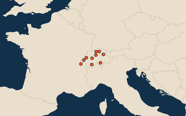
All of Europe
More in Switzerland
- 25 largest cities in Switzerland
- Cantons of Switzerland
- 21 largest lakes in Switzerland
- 12 longest rivers in Switzerland
- 25 highest peaks in Switzerland
- 25 largest glaciers in Switzerland by area
- Flags of the cantons of Switzerland
- 10 largest cities in Switzerland
- 13 best known World Heritage Sites in Switzerland
- Cities ranked 26–50 in Switzerland
Other countries of Europe
- States of Germany
- 10 most populous states of Germany
- Districts of Germany
- 25 most populous districts of Germany
- Regions of Italy
- 10 most populous regions of Italy
- Provinces of Italy
- 25 most populous provinces of Italy
How the figures are measured
Population of each region: a 2025 estimate: the latest official figure (a census or an estimate, as each item names it) scaled with the rest of its country’s regions to the World Bank’s 2025 national total, so a country’s regions share one year. Each item names its source and year. Regions without a figure are left out.