GeotchaA geography quiz on a real globe
States of south India
6 states, each one drawn on a satellite globe. Name it when it lights up, find it when you are given its name, or type every one you can remember in Name all.
Free to start: a few quizzes a day cost nothing, and Geotcha Plus opens every quiz. What you miss comes back for review until it sticks.
The full list
About this quiz
Karnataka is the largest of the 6 states in this quiz, at 191,791 km²; Puducherry is the smallest listed, at 492 km². The three largest hold 76% of the combined area of all 6.
What they are known for
- Karnataka: Southern state of Bengaluru's tech hub, a royal palace city, Hampi's ruins and coffee estates.
- Andhra Pradesh: Southeastern coastal state of Tirupati's temple, spicy cuisine, the Krishna and Godavari deltas and Visakhapatnam port.
- Tamil Nadu: Southern state of Dravidian temple towers at Madurai, Chennai's Marina beach, Tamil language and Kanchipuram silk.
- Telangana: Southern Deccan state formed in 2014, with Hyderabad's Charminar, biryani, pearls and tech parks.
- Kerala: Southern coast state of backwaters and houseboats, spice plantations, Kathakali dance and a leading literacy rate.
- Puducherry: Former French colony on the southeastern coast, with tidy boulevards, yellow colonial villas and the Sri Aurobindo ashram.
The states
- 1Karnataka191,791 km²
- 2Andhra Pradesh162,970 km²
- 3Tamil Nadu130,058 km²
- 4Telangana112,077 km²
- 5Kerala38,863 km²
- 6Puducherry492 km²
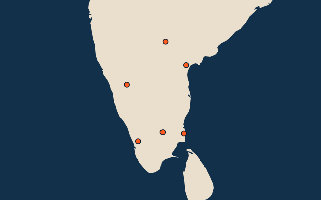
On the map
More in South India
Similar quizzes
How the figures are measured
The 6 states of south India. South India: Andhra Pradesh, Karnataka, Kerala, Tamil Nadu, Telangana and Puducherry.