GeotchaA geography quiz on a real globe
Provinces of east China
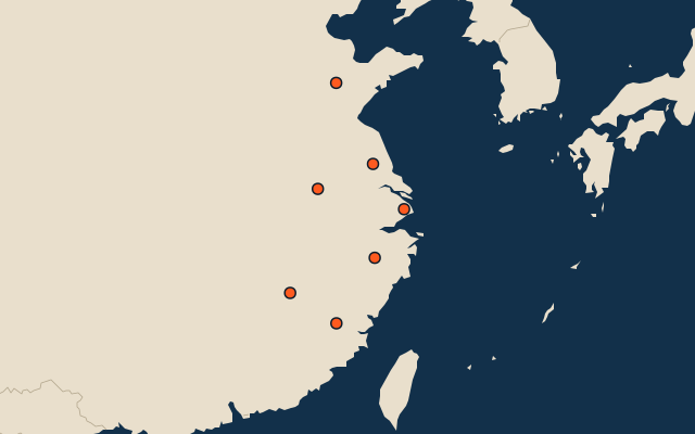
7 provinces, each one drawn on a satellite globe. Name it when it lights up, find it when you are given its name, or type every one you can remember in Name all.
Free to start: a few quizzes a day cost nothing, and Geotcha Plus opens every quiz. What you miss comes back for review until it sticks.
The full list
About this quiz
Jiangxi is the largest of the 7 provinces in this quiz, at 166,900 km²; Shanghai is the smallest listed, at 6,341 km². The three largest hold 59% of the combined area of all 7.
What they are known for
- Jiangxi: Holds China’s largest freshwater lake, Poyang; Jingdezhen porcelain is made here.
- Shandong: Birthplace of Confucius; Mount Tai and Qingdao are here.
- Anhui: Huangshan’s granite peaks and twisted pines are here; capital Hefei.
- Fujian: Home of Xiamen, Hakka round houses and oolong tea.
- Zhejiang: Hangzhou’s West Lake, the Zhoushan archipelago and Alibaba’s headquarters are here.
- Jiangsu: Flattest province; Nanjing and the canal city of Suzhou are here.
The provinces
- 1Jiangxi166,900 km²
- 2Shandong156,700 km²
- 3Anhui139,000 km²
- 4Fujian121,400 km²
- 5Zhejiang101,800 km²
- 6Jiangsu98,285 km²
- 7Shanghai6,341 km²
On the map
More in East China
- 25 largest cities in east China
- 14 largest lakes in east China
- 25 longest rivers in east China
- 7 highest peaks in east China
- 25 largest islands in east China
Similar quizzes
How the figures are measured
The 7 provinces of east China. East China: Shanghai, Jiangsu, Zhejiang, Anhui, Fujian, Jiangxi and Shandong.