GeotchaA geography quiz on a real globe
25 rivers in the world with the most countries along their course
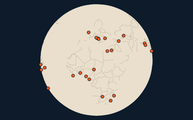
25 rivers, each one drawn on a satellite globe. Name it when it lights up, find it when you are given its name, or type every one you can remember in Name all.
Free to start: a few quizzes a day cost nothing, and Geotcha Plus opens every quiz. What you miss comes back for review until it sticks.
The full list
About this quiz
The quiz covers 25 rivers, from the Danube and the Nile to the Chari. They lie in 22 countries; Brazil has the most, with three.
What they are known for
- Danube: Passes through four capital cities, more than any other river.
- Nile: Flows north through a desert to the Mediterranean; its delta cradled an ancient civilisation.
- Mekong: Flows past Vientiane and Phnom Penh before splitting into a delta called the 'Nine Dragons' in southern Vietnam.
- Rhine: Flows past Basel, Strasbourg, Cologne and the Lorelei rock to the North Sea
- Drava: Flows from the Italian Alps through Austria and Slovenia, then along the Croatia–Hungary border
- Niger: Takes a strange boomerang route, first heading toward the Sahara before turning back to the Gulf of Guinea.
- Tisza: Flows across the Hungarian plain past Szeged to the Danube in Serbia
- Zambezi: Plunges over Victoria Falls, "the smoke that thunders".
The rivers
- 1Danube Romania
- 2Nile Sudan
- 3Mekong Laos
- 4Rhine Germany
- 5Drava Croatia
- 6Niger Mali
- 7Tisza Hungary
- 8Zambezi Zambia
- 9Amu Darya Turkmenistan
- 10Aras Turkey
- 11Cuando Angola
- 12Jordan Israel
- 13Limpopo Mozambique
- 14Mur Austria
- 15Oti Ghana
- 16Paraguay Brazil
- 17Putumayo (Içá) Colombia
- 18Sava Croatia
- 19Torsa India
- 20Acre Brazil
- 21Amazon Brazil
- 22Brahmaputra China
- 23Campo Cameroon
- 24Cavalla Côte d'Ivoire
- 25Chari Chad
On the map
More of the world
- 25 largest cities in the world
- 25 largest countries in the world
- 50 largest regions in the world
- 25 largest lakes in the world
- 25 longest rivers in the world
- 25 highest peaks in the world
- 25 largest islands in the world
- 25 longest fjords in the world
- Flags of the world
- 50 largest cities in the world
The whole world
How the figures are measured
The countries the river’s drawn course runs through or along, from its mouth to the source its length is measured from: the Nile from the Kagera’s headwaters in Rwanda and Burundi, the Danube along Moldova’s few hundred metres of bank. A country counts when 10 km of the course lies in it (3% of a shorter river), or when Wikidata names it and the course touches it. A river drawn as a point is left out. Each named river counts on its own: the river that carries the name, from its source to its mouth. Headstreams and tributaries with names of their own are rivers of their own, so the Missouri and the Mississippi are two rivers here, as are the Irtysh and the Ob (the Longest River Systems set measures such chains as one system, from the most distant source). A named section of a river is that river: the Solimões, as the Amazon’s upper course is called in Brazil, is the Amazon. Where the recorded length runs from a differently named headwater (the Congo’s from the Lualaba’s source), the course is drawn on up that headwater. Rivers under 200 km are in only when they are well known (30 or more Wikipedia editions), and a river whose mapped course covers under half its recorded length is left out. Rivers in Antarctica are left out unless the quiz includes Antarctica.