GeotchaA geography quiz on a real globe
25 largest islands in European Russia
25 islands, each one drawn on a satellite globe. Name it when it lights up, find it when you are given its name, or type every one you can remember in Name all.
Free to start: a few quizzes a day cost nothing, and Geotcha Plus opens every quiz. What you miss comes back for review until it sticks.
The full list
About this quiz
Severny Island is the largest of the 25 islands in this quiz, at 47,079 km²; Payer Island is the smallest listed, at 151 km². The three largest hold 85% of the combined area of all 25.
What they are known for
- Severny Island: The larger of a Russian Arctic archipelago's two big islands, where the Tsar Bomba, the biggest nuclear bomb ever, was set off in 1961.
- Yuzhny Island: The smaller of a Russian Arctic archipelago's two big islands, with the Belushya Guba base; the Matochkin Shar strait divides it from its twin.
The islands
- 1Severny Island47,079 km²
- 2Yuzhny Island33,275 km²
- 3Kolguyev Island5,200 km²
- 4Vaygach Island3,329 km²
- 5Zemlya Georga2,821 km²
- 6Alexandra Land1,095 km²
- 7Hall Island1,049 km²
- 8Salisbury Island960 km²
- 9Mezhdusharsky Island742 km²
- 10McClintock Island612 km²
- 11Jackson Island521 km²
- 12Hooker Island508 km²
- 13Ziegler Island448 km²
- 14Champ Island374 km²
- 15Luigi Island371 km²
- 16Salm Island344 km²
- 17Charles Alexander Island329 km²
- 18Gorodomlya Island314 km²
- 19Rudolf Island297 km²
- 20Northbrook289 km²
- 21Solovetsky Island246 km²
- 22Wiener Neustadt Island237 km²
- 23Bruce Island191 km²
- 24Nansen Island164 km²
- 25Payer Island151 km²
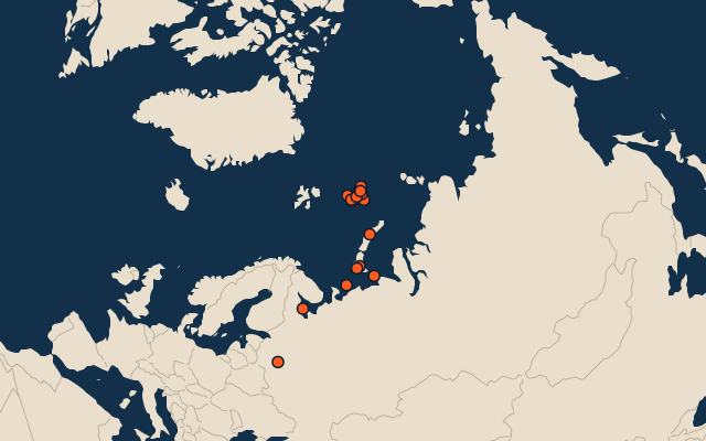
On the map
More in European Russia
- 25 largest cities in European Russia
- 25 largest lakes in European Russia
- 25 longest rivers in European Russia
- 25 highest peaks in European Russia
Similar quizzes
- 25 largest islands in the northern hemisphere
- 25 largest islands in the southern hemisphere
- 25 largest islands in the eastern hemisphere
- 25 largest islands in the western hemisphere
- 25 largest islands in the tropics
- 25 largest islands in the Arctic
- 25 largest islands in Scandinavia
- 25 largest islands in the Nordic countries
The whole world
How the figures are measured
Land area in km²: the Largest Islands set’s figure for its islands, else Wikidata’s (P2046) where it fits the outline, else the area of the outline. Every island Natural Earth draws at 1:10m that Wikidata names, of 5 km² or more (smaller ones when well known), and every island of the Largest Islands set. Countries are those the island’s land lies in, from the outlines. European Russia: places in Russia classified as Europe in the quiz data. Places are by geography: what lies in a dependency counts for its own region (Puerto Rico’s islands are the Caribbean’s, Réunion’s Africa’s), and Hawaii is in Polynesia.