GeotchaA geography quiz on a real globe
Departmental capitals of Peru
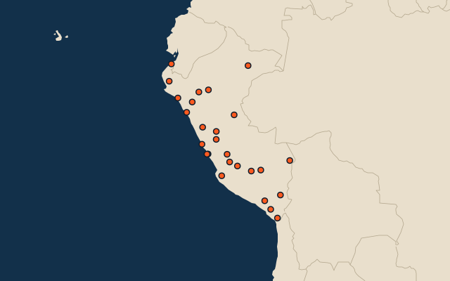
26 departmental capitals, each one drawn on a satellite globe. Name it when it lights up, find it when you are given its name, tell its flag from three others, or type every one you can remember in Name all.
Free to start: a few quizzes a day cost nothing, and Geotcha Plus opens every quiz. What you miss comes back for review until it sticks.
The full list
About this quiz
Lima is the largest of the 26 departmental capitals in this quiz, at 11.2 M; Chachapoyas is the smallest listed, at 40 k. Lima's population is 9.1 times Callao's (1.2 M). The three largest hold 68% of the combined population of all 26.
The departmental capitals
- 1Lima11.2 M
- 2Callao1.2 M
- 3Arequipa1.1 M
- 4Trujillo1 M
- 5Chiclayo663 k
- 6Piura547 k
- 7Cusco492 k
- 8Huancayo451 k
- 9Iquitos431 k
- 10Pucallpa396 k
- 11Tacna334 k
- 12Ica326 k
- 13Ayacucho240 k
- 14Cajamarca228 k
- 15Huánuco221 k
- 16Huacho173 k
- 17Puno137 k
- 18Huaraz133 k
- 19Tumbes111 k
- 20Puerto Maldonado100 k
- 21Abancay82 k
- 22Moquegua82 k
- 23Cerro de Pasco61 k
- 24Moyobamba57 k
- 25Huancavelica57 k
- 26Chachapoyas40 k
On the map
All of South America
More in Peru
- 25 largest cities in Peru
- Regions of Peru
- 25 longest rivers in Peru
- 25 highest peaks in Peru
- 6 largest islands in Peru
- 11 best known World Heritage Sites in Peru
- Flags of the regions of Peru
- 10 largest cities in Peru
- 10 most populous regions of Peru
- Cities ranked 26–50 in Peru
In the regions of Peru
- 7 largest cities in Áncash
- 6 largest cities in Arequipa
- 8 largest cities in Cajamarca
- 10 largest cities in Cuzco Department
- 10 largest cities in Ica
- 10 largest cities in Junín
- 10 largest cities in La Libertad, Peru
- 10 largest cities in Lambayeque
Other countries of South America
- 25 largest cities in Brazil
- 10 largest cities in Brazil
- Cities ranked 26–50 in Brazil
- State capitals of Brazil
- 25 largest cities in Colombia
- 10 largest cities in Colombia
- Cities ranked 26–50 in Colombia
- Departmental capitals of Colombia
The whole world
How the figures are measured
Capitals of first-level administrative units (states, provinces, regions): the capital Wikidata records for the unit (P36), else the seat GeoNames records for it (PPLA); a second, summer or winter capital is left out. A national capital is in only where it is also its unit’s seat (Canberra for the Australian Capital Territory, Brasília for the Federal District), not where the unit has another capital (Ottawa: Toronto; Amsterdam: Haarlem).