GeotchaA geography quiz on a real globe
15 largest lakes in the Baltic states
15 lakes, each one drawn on a satellite globe. Name it when it lights up, find it when you are given its name, or type every one you can remember in Name all.
Free to start: a few quizzes a day cost nothing, and Geotcha Plus opens every quiz. What you miss comes back for review until it sticks.
The full list
About this quiz
Võrtsjärv is the largest of the 15 lakes in this quiz, at 269 km²; Pühajärv is the smallest listed, at 3 km². Võrtsjärv's area is 3.3 times Lake Lubāns's (81 km²). The three largest hold 65% of the combined area of all 15. They lie in three countries; Estonia has the most, with seven.
What they are known for
- Võrtsjärv: Shallow lake in central Estonia whose river runs through Tartu to Lake Peipus
- Drūkšiai: Lake on the Lithuania–Belarus border that cooled the Ignalina nuclear plant
The lakes
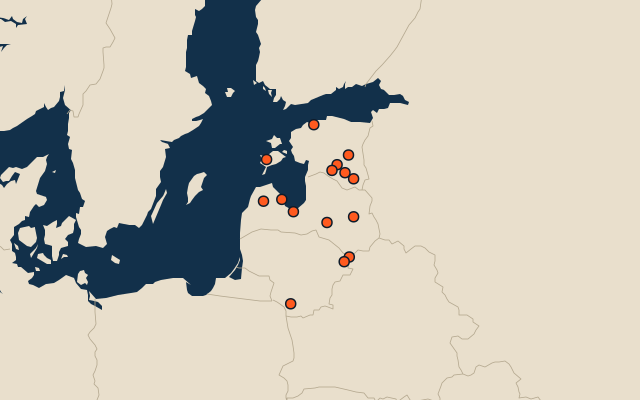
- 1Võrtsjärv Estonia269 km²
- 2Lake Lubāns Latvia81 km²
- 3Drūkšiai Lithuania45 km²
- 4Lake Engure Latvia40 km²
- 5Lake Usma Latvia35 km²
- 6Pljavinjas Latvia29 km²
- 7Babīte Latvia26 km²
- 8Dysnai Lithuania24 km²
- 9Dusia Lithuania23 km²
- 10Lake Ülemiste Estonia9 km²
- 11Saadjärv Estonia7 km²
- 12Lake Vagula Estonia6 km²
- 13Veisjärv Estonia5 km²
- 14Karujärv Estonia3 km²
- 15Pühajärv Estonia3 km²
On the map
More in Baltic states
Similar quizzes
- 15 largest lakes in the Andes
- 10 largest lakes in the Rocky Mountains
- 6 largest lakes in the Himalayas
- 19 largest lakes in the Appalachian Mountains
- 25 largest lakes in the Scandinavian Mountains
- 12 largest lakes in the Coast Mountains
- 25 largest lakes in the Alps
- 6 largest lakes in the Sierra Madre del Sur
The whole world
How the figures are measured
Lakes by surface area in km². The Caspian Sea counts as a lake. Coastal lagoons do not, and a salt pan that is dry most years (Lake Eyre) is not ranked by size. A lake belongs to every country on its shores. Natural lakes only: reservoirs held back by a dam are left out. The Baltic states: what lies inside the region’s outline, by each item’s point (a lake’s centre, a river’s mouth, a summit).