GeotchaA geography quiz on a real globe
25 longest rivers of the Elbe basin
25 rivers, each one drawn on a satellite globe. Name it when it lights up, find it when you are given its name, or type every one you can remember in Name all.
Free to start: a few quizzes a day cost nothing, and Geotcha Plus opens every quiz. What you miss comes back for review until it sticks.
The full list
About this quiz
The Elbe is the longest of the 25 rivers in this quiz, at 1,094 km; the Radbuza is the shortest listed, at 110 km. The Elbe's length is 2.5 times the Vltava's (430 km). Germany has 17 of the 25, in a list that spans two countries.
What they are known for
- Elbe: Rises in the Czech Krkonoše and flows past Dresden and Magdeburg to Hamburg
- Vltava: The river of Prague, crossed by the Charles Bridge; Smetana set it to music
- Saale: Flows past Jena and Halle to the Elbe
- Spree: Flows through Berlin past the Reichstag and Museum Island
- Havel: Flows through Berlin's western lakes past Spandau and Potsdam to the Elbe
- Weisse Elster: Flows into the Saale
- Ohře: Flows past Karlovy Vary to the Elbe
- Sázava: Flows into the Vltava
The rivers
- 1Elbe Germany1,094 km
- 2Vltava Czechia430 km
- 3Saale Germany413 km
- 4Spree Germany382 km
- 5Havel Germany325 km
- 6Weisse Elster Germany257 km
- 7Ohře Czechia247 km
- 8Sázava Czechia226 km
- 9Elde Germany208 km
- 10Lužnice Czechia208 km
- 11Unstrut Germany192 km
- 12Black Elster Germany179 km
- 13Bode Germany169 km
- 14Jizera Czechia167 km
- 15Zwickau Mulde Germany166 km
- 16Oste Germany156 km
- 17Mulde Germany147 km
- 18Berounka Czechia139 km
- 19Ilm Germany134 km
- 20Rhin Germany133 km
- 21Zschopau Germany128 km
- 22Ilmenau Germany125 km
- 23Freiberger Mulde Germany124 km
- 24Otava Czechia112 km
- 25Radbuza Czechia110 km
On the map
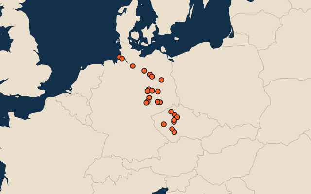
More in Elbe basin
Similar quizzes
- 25 longest rivers of the Amazon basin
- 25 longest rivers of the Congo basin
- 25 longest rivers of the Mississippi basin
- 25 longest rivers of the Ob basin
- 25 longest rivers of the Río de la Plata basin
- 23 longest rivers of the Nile basin
- 25 longest rivers of the Yenisei basin
- 25 longest rivers of the Lena basin
The whole world
How the figures are measured
Length in km as Wikidata records it (P2043, the best-ranked figure). Each named river counts on its own: the river that carries the name, from its source to its mouth. Headstreams and tributaries with names of their own are rivers of their own, so the Missouri and the Mississippi are two rivers here, as are the Irtysh and the Ob (the Longest River Systems set measures such chains as one system, from the most distant source). A named section of a river is that river: the Solimões, as the Amazon’s upper course is called in Brazil, is the Amazon. Where the recorded length runs from a differently named headwater (the Congo’s from the Lualaba’s source), the course is drawn on up that headwater. Rivers under 200 km are in only when they are well known (30 or more Wikipedia editions), and a river whose mapped course covers under half its recorded length is left out. Rivers in Antarctica are left out unless the quiz includes Antarctica. The Elbe basin: the Elbe and every river here that flows into it, directly or through other rivers and lakes, following where Wikidata says each river flows (P403) downstream.