GeotchaA geography quiz on a real globe
25 longest rivers in the American South
25 rivers, each one drawn on a satellite globe. Name it when it lights up, find it when you are given its name, or type every one you can remember in Name all.
Free to start: a few quizzes a day cost nothing, and Geotcha Plus opens every quiz. What you miss comes back for review until it sticks.
The full list
About this quiz
The Mississippi is the longest of the 25 rivers in this quiz, at 3,766 km; the Potomac is the shortest listed, at 665 km.
What they are known for
- Mississippi: Drains all or part of 31 US states; its longer branch rises in the Rocky Mountains of Montana and meets the other near St. Louis.
- Rio Grande: Forms the Texas–Mexico border and goes by a different Spanish name on the southern bank.
- Arkansas: Rises near Leadville in the Colorado Rockies and runs east past Wichita, Tulsa and Little Rock to the Mississippi.
- Red River (US): Forms the Texas–Oklahoma border; once a Mississippi tributary, it now feeds the Atchafalaya.
- Ohio: Formed at Pittsburgh; carries more water into the Mississippi than any other tributary.
- Pecos: Rio Grande tributary running past Roswell, through New Mexico and West Texas.
- Canadian: Flows into the Arkansas
- Colorado (Texas): Flows entirely within one US state through its capital, Austin.
The rivers
- 1Mississippi3,766 km
- 2Rio Grande3,051 km
- 3Arkansas2,364 km
- 4Red River (US)2,189 km
- 5Ohio1,579 km
- 6Pecos1,560 km
- 7Canadian1,458 km
- 8Colorado (Texas)1,387 km
- 9Brazos1,352 km
- 10White River1,162 km
- 11Trinity1,140 km
- 12Cimarron1,123 km
- 13Cumberland1,107 km
- 14Tennessee1,049 km
- 15Ouachita974 km
- 16Sabine820 km
- 17Neosho745 km
- 18Pearl River (Mississippi–Louisiana)715 km
- 19Susquehanna715 km
- 20North Canadian River710 km
- 21Chattahoochee702 km
- 22Guadalupe700 km
- 23St. Francis686 km
- 24Neches669 km
- 25Potomac665 km
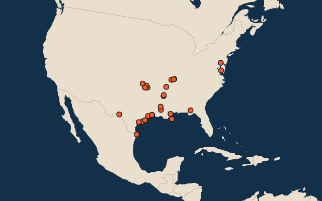
On the map
More in American South
- 25 largest cities in the American South
- States of the American South
- 25 largest natural lakes in the American South
- 14 highest peaks in the American South
- 25 largest islands in the American South
- 25 largest lakes and reservoirs in the American South
Similar quizzes
- 25 longest rivers in the northern hemisphere
- 25 longest rivers in the southern hemisphere
- 25 longest rivers in the eastern hemisphere
- 25 longest rivers in the tropics
- 25 longest rivers in the Arctic
- 25 longest rivers in the Midwest
- 25 longest rivers in the American West
- 25 longest rivers in the northeastern United States
The whole world
How the figures are measured
Length in km as Wikidata records it (P2043, the best-ranked figure). Each named river counts on its own: the river that carries the name, from its source to its mouth. Headstreams and tributaries with names of their own are rivers of their own, so the Missouri and the Mississippi are two rivers here, as are the Irtysh and the Ob (the Longest River Systems set measures such chains as one system, from the most distant source). A named section of a river is that river: the Solimões, as the Amazon’s upper course is called in Brazil, is the Amazon. Where the recorded length runs from a differently named headwater (the Congo’s from the Lualaba’s source), the course is drawn on up that headwater. Rivers under 200 km are in only when they are well known (30 or more Wikipedia editions), and a river whose mapped course covers under half its recorded length is left out. The American South: the US Census South, 16 states from Delaware to Texas and the District of Columbia. Places are by geography: what lies in a dependency counts for its own region (Puerto Rico’s islands are the Caribbean’s, Réunion’s Africa’s), and Hawaii is in Polynesia.