GeotchaA geography quiz on a real globe
25 longest rivers in northeast China
25 rivers, each one drawn on a satellite globe. Name it when it lights up, find it when you are given its name, or type every one you can remember in Name all.
Free to start: a few quizzes a day cost nothing, and Geotcha Plus opens every quiz. What you miss comes back for review until it sticks.
The full list
About this quiz
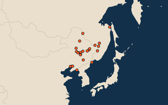
The Amur is the longest of the 25 rivers in this quiz, at 2,824 km; the Huifa He is the shortest listed, at 267 km. The Amur's length is about twice the Songhua's (1,434 km). China has 22 of the 25, in a list that spans three countries.
What they are known for
- Amur: Forms much of the border between Russia and China; its Chinese name refers to a dark mythical beast.
- Songhua: Largest tributary of the Amur, flowing past Harbin in Manchuria.
- Nen: Flows into the Songhua
- Liao: Main river of southern Manchuria, crossing the plain west of Shenyang to the Bohai Sea; a whole province is named after it.
- Ussuri: Forms the Russia–China border north to the Amur at Khabarovsk
- Yalu: Forms the China–North Korea border, crossed by the Friendship Bridge at Dandong
- Mudan: Flows into the Songhua
- Chuo'er He: Flows into the Nen
The rivers
- 1Amur Russia2,824 km
- 2Songhua China1,434 km
- 3Nen China1,370 km
- 4Liao China1,345 km
- 5Ussuri Russia897 km
- 6Yalu North Korea813 km
- 7Mudan China700 km
- 8Chuo'er He China610 km
- 9Naoli China596 km
- 10Taoer China595 km
- 11Holin Gol China590 km
- 12Muling China577 km
- 13Tumen China549 km
- 14Hulan China532 km
- 15Tangwang He China492 km
- 16Daling China460 km
- 17Lalin He China448 km
- 18Gan (Inner Mongolia) China446 km
- 19Huma China435 km
- 20Hun China415 km
- 21Taizi China406 km
- 22Yinma China387 km
- 23Yitong China344 km
- 24Mayi China341 km
- 25Huifa He China267 km
On the map
More in Northeast China
Similar quizzes
- 25 longest rivers in northwest China
- 25 longest rivers in north China
- 25 longest rivers in east China
- 25 longest rivers in central China
- 11 longest rivers in south China
- 25 longest rivers in southwest China
- 12 longest rivers in northeast India
- 25 longest rivers in south India
The whole world
How the figures are measured
Length in km as Wikidata records it (P2043, the best-ranked figure). Each named river counts on its own: the river that carries the name, from its source to its mouth. Headstreams and tributaries with names of their own are rivers of their own, so the Missouri and the Mississippi are two rivers here, as are the Irtysh and the Ob (the Longest River Systems set measures such chains as one system, from the most distant source). A named section of a river is that river: the Solimões, as the Amazon’s upper course is called in Brazil, is the Amazon. Where the recorded length runs from a differently named headwater (the Congo’s from the Lualaba’s source), the course is drawn on up that headwater. Rivers under 200 km are in only when they are well known (30 or more Wikipedia editions), and a river whose mapped course covers under half its recorded length is left out. Northeast China: Heilongjiang, Jilin and Liaoning. Places are by geography: what lies in a dependency counts for its own region (Puerto Rico’s islands are the Caribbean’s, Réunion’s Africa’s), and Hawaii is in Polynesia.