GeotchaA geography quiz on a real globe
19 longest rivers in Nenets
19 rivers, each one drawn on a satellite globe. Name it when it lights up, find it when you are given its name, or type every one you can remember in Name all.
Free to start: a few quizzes a day cost nothing, and Geotcha Plus opens every quiz. What you miss comes back for review until it sticks.
The full list
About this quiz
The Pechora is the longest of the 19 rivers in this quiz, at 1,809 km; the Vorkuta is the shortest listed, at 182 km. The Pechora's length is 3.3 times the Kolva (Usa)'s (546 km).
What they are known for
- Pechora: Flows from the northern Urals through the Komi Republic's taiga and tundra to the Barents Sea.
- Kolva (Usa): Flows into the Usa
- Shapkina: Flows into the Pechora
- Sula (Pechora): Flows into the Pechora
- Adzva: Flows into the Usa
- Laya: Flows into the Pechora
- Bolshaya Rogovaya: Flows into the Usa
- Chyornaya: Flows into the Pechora Sea
The rivers
- 1Pechora1,809 km
- 2Kolva (Usa)546 km
- 3Shapkina499 km
- 4Sula (Pechora)353 km
- 5Adzva334 km
- 6Laya332 km
- 7Bolshaya Rogovaya311 km
- 8Chyornaya308 km
- 9More-Yu272 km
- 10Oma268 km
- 11Kara257 km
- 12Pyosha257 km
- 13Kosma251 km
- 14Vizhas219 km
- 15Korotaikha199 km
- 16Indiga193 km
- 17Silovayakha192 km
- 18Kuya186 km
- 19Vorkuta182 km
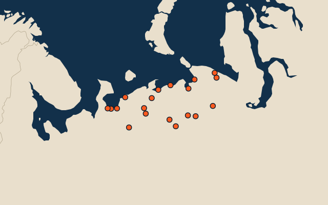
On the map
All of Russia
Elsewhere in Russia
- 8 longest rivers in Adygeya Republic
- 15 longest rivers in Altai
- 20 longest rivers in Altai Krai
- 23 longest rivers in Amur
- 25 longest rivers in Arkhangelskaya
- 20 longest rivers in Bashkortostan Republic
- 10 longest rivers in Belgorod
- 8 longest rivers in Bryansk
Russia, by kind
The whole world
How the figures are measured
Length in km as Wikidata records it (P2043, the best-ranked figure). Each named river counts on its own: the river that carries the name, from its source to its mouth. Headstreams and tributaries with names of their own are rivers of their own, so the Missouri and the Mississippi are two rivers here, as are the Irtysh and the Ob (the Longest River Systems set measures such chains as one system, from the most distant source). A named section of a river is that river: the Solimões, as the Amazon’s upper course is called in Brazil, is the Amazon. Where the recorded length runs from a differently named headwater (the Congo’s from the Lualaba’s source), the course is drawn on up that headwater. Rivers under 200 km are in only when they are well known (30 or more Wikipedia editions), and a river whose mapped course covers under half its recorded length is left out. An item counts for every first-level unit (state, province, county) it touches: a lake or island by its outline, within about 1.5 km; a river by its course, when 10 km of it (3% of a shorter river) lies in or along the unit; a summit, a cape or anything without a shape by its point.