GeotchaA geography quiz on a real globe
20 longest rivers in Slovakia
20 rivers, each one drawn on a satellite globe. Name it when it lights up, find it when you are given its name, or type every one you can remember in Name all.
Free to start: a few quizzes a day cost nothing, and Geotcha Plus opens every quiz. What you miss comes back for review until it sticks.
The full list
About this quiz
The Danube is the longest of the 20 rivers in this quiz, at 2,850 km; the Orava is the shortest listed, at 60 km. The Danube's length is about three times the Tisza's (966 km). Slovakia has 12 of the 20, in a list that spans six countries.
What they are known for
- Danube: Passes through four capital cities, more than any other river.
- Tisza: Flows across the Hungarian plain past Szeged to the Danube in Serbia
- Váh: Slovak river flowing past Piešťany spa to the Danube
- Morava: Forms the Slovak–Austrian border, joining the Danube below Devín Castle near Bratislava
- Hron: Slovak river from the Low Tatras to the Danube opposite Esztergom
- Hornád: Flows into the Sajó
- Dunajec: Flows into the Vistula
- Ipoly: Flows into the Danube
The rivers
- 1Danube Romania2,850 km
- 2Tisza Hungary966 km
- 3Váh Slovakia433 km
- 4Morava Czechia388 km
- 5Hron Slovakia298 km
- 6Hornád Slovakia286 km
- 7Dunajec Poland274 km
- 8Ipoly Slovakia233 km
- 9Sajó Hungary229 km
- 10Nitra Slovakia197 km
- 11Latorica Ukraine182 km
- 12Poprad Slovakia174 km
- 13Ondava Slovakia146 km
- 14Topľa Slovakia130 km
- 15Laborec Slovakia129 km
- 16Torysa Slovakia129 km
- 17Little Danube Slovakia128 km
- 18Uzh Ukraine127 km
- 19Bodrog Hungary67 km
- 20Orava Slovakia60 km
On the map
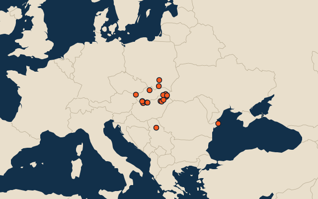
All of Europe
- 25 longest rivers in Europe
- Rivers in Europe among the world’s 100 longest
- 25 best known rivers in Europe
More in Slovakia
- 25 largest cities in Slovakia
- Regions of Slovakia
- 25 highest peaks in Slovakia
- 8 best known wine regions in Slovakia
- Flags of the regions of Slovakia
- 10 largest cities in Slovakia
- 8 most populous regions of Slovakia
- Cities ranked 26–50 in Slovakia
- Regional capitals of Slovakia
In the regions of Slovakia
Other countries of Europe
- 25 longest rivers in Germany
- 25 longest rivers in Italy
- 25 longest rivers in Russia
- 25 longest rivers in France
- 25 longest rivers in the United Kingdom
- 25 longest rivers in Spain
- 25 longest rivers in Poland
- 12 longest rivers in the Netherlands
The whole world
How the figures are measured
Length in km as Wikidata records it (P2043, the best-ranked figure). Each named river counts on its own: the river that carries the name, from its source to its mouth. Headstreams and tributaries with names of their own are rivers of their own, so the Missouri and the Mississippi are two rivers here, as are the Irtysh and the Ob (the Longest River Systems set measures such chains as one system, from the most distant source). A named section of a river is that river: the Solimões, as the Amazon’s upper course is called in Brazil, is the Amazon. Where the recorded length runs from a differently named headwater (the Congo’s from the Lualaba’s source), the course is drawn on up that headwater. Rivers under 200 km are in only when they are well known (30 or more Wikipedia editions), and a river whose mapped course covers under half its recorded length is left out.