GeotchaA geography quiz on a real globe
17 largest islands in Fujian
17 islands, each one drawn on a satellite globe. Name it when it lights up, find it when you are given its name, or type every one you can remember in Name all.
Free to start: a few quizzes a day cost nothing, and Geotcha Plus opens every quiz. What you miss comes back for review until it sticks.
The full list
About this quiz
Pingtan Island is the largest of the 17 islands in this quiz, at 267 km²; Gulangyu is the smallest listed, at 2 km². The three largest hold 57% of the combined area of all 17.
The islands
- 1Pingtan Island267 km²
- 2Dongshan Island220 km²
- 3Xiamen Island158 km²
- 4Cangshan Island142 km²
- 5Jiangyin Bandao70 km²
- 6Sandu Dao51 km²
- 7Nanri Island45 km²
- 8Langqi Island40 km²
- 9Fuying Dao25 km²
- 10Dayu Shan (Fujian)23 km²
- 11Dalian Dao20 km²
- 12Xiyang island18 km²
- 13Meizhou Island16 km²
- 14Yutou Dao16 km²
- 15Dadeng Island14 km²
- 16Dongan Island13 km²
- 17Gulangyu2 km²
On the map
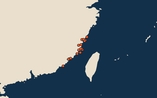
All of China
More in Fujian
Elsewhere in China
China, by kind
The whole world
How the figures are measured
Land area in km²: the Largest Islands set’s figure for its islands, else Wikidata’s (P2046) where it fits the outline, else the area of the outline. Every island Natural Earth draws at 1:10m that Wikidata names, of 5 km² or more (smaller ones when well known), and every island of the Largest Islands set. Countries are those the island’s land lies in, from the outlines. An item counts for every first-level unit (state, province, county) it touches: a lake or island by its outline, within about 1.5 km; a river by its course, when 10 km of it (3% of a shorter river) lies in or along the unit; a summit, a cape or anything without a shape by its point.