GeotchaA geography quiz on a real globe
13 largest islands formerly held by Portugal
13 islands, each one drawn on a satellite globe. Name it when it lights up, find it when you are given its name, or type every one you can remember in Name all.
Free to play, with no account needed. What you miss comes back for review until it sticks.
The islands
- 1Flores13,540 km²
- 2Bioko1,935 km²
- 3Ambon Island804 km²
- 4Salsette619 km²
- 5Adonara507 km²
- 6Solor216 km²
- 7Tidore Island116 km²
- 8Ternate Island102 km²
- 9Tarout Island32 km²
- 10Annobón Island17 km²
- 11Arguin14 km²
- 12Island of Mozambique2 km²
- 13Gorée1 km²
Land area in km²: the Largest Islands set’s figure for its islands, else Wikidata’s (P2046) where it fits the outline, else the area of the outline. Every island Natural Earth draws at 1:10m that Wikidata names, of 5 km² or more (smaller ones when well known), and every island of the Largest Islands set. Countries are those the island’s land lies in, from the outlines. Islands in Antarctica are left out unless the quiz includes Antarctica. Portugal (with the Portuguese Empire): places once under its rule and not now, from Wikidata’s dated country statements and colonial-empire membership, and the CIA World Factbook’s independence dates; military occupations of a few years are left out.
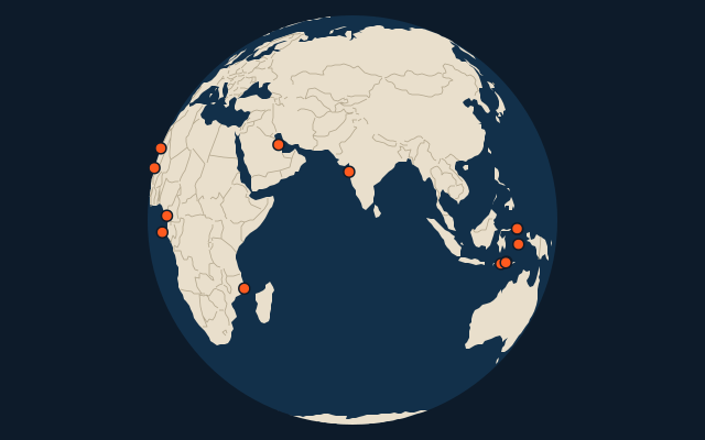
On the map
More in Portugal
- Countries formerly held by Portugal
- 25 largest cities formerly held by Portugal
- Countries with parts formerly held by Portugal