GeotchaA geography quiz on a real globe
10 most populous states and federal territories of Malaysia
10 states and federal territories, each one drawn on a satellite globe. Name it when it lights up, find it when you are given its name, tell its flag from three others, or type every one you can remember in Name all.
Free to start: a few quizzes a day cost nothing, and Geotcha Plus opens every quiz. What you miss comes back for review until it sticks.
The full list
About this quiz
Selangor is the largest of the 10 states and federal territories in this quiz, at 7.3 M; Pahang is the smallest listed, at 1.5 M. Selangor's population is 1.6 times Johor's (4.5 M). The three largest hold 51% of the combined population of all 10.
What they are known for
- Selangor: Batu Caves' golden Murugan statue, Shah Alam's blue mosque, Port Klang and the Sepang F1 circuit.
- Johor: Southernmost state: causeway to Singapore, Legoland, Tanjung Piai mangroves and Endau-Rompin forest.
- Sabah: Mount Kinabalu, Sipadan diving, orangutans at Sepilok and the northern tip of Borneo.
- Sarawak: Borneo's Mulu caves, Iban longhouses, Rainforest World Music Festival and a 'cat city' capital.
- Kedah: Rice bowl of Malaysia, with Langkawi's islands, Gunung Jerai and the ancient Bujang Valley temples.
- Perak: Ipoh's white coffee and cave temples, Lenggong Valley archaeology, tin mining and Pangkor island.
- Kuala Lumpur: Federal capital with the Petronas Twin Towers, Merdeka Square, Bukit Bintang and Petaling Street.
- Kelantan: Malay cultural heartland on the east coast: shadow puppets, giant kites, batik, silat and a Thai border.
The states and federal territories
- 1Selangor7.3 M
- 2Johor4.5 M
- 3Sabah4.3 M
- 4Sarawak2.8 M
- 5Kedah2.4 M
- 6Perak2.4 M
- 7Kuala Lumpur2.3 M
- 8Kelantan2 M
- 9Penang2 M
- 10Pahang1.5 M
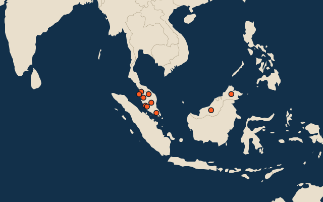
On the map
All of Asia
More in Malaysia
- 25 largest cities in Malaysia
- States and federal territories of Malaysia
- 12 longest rivers in Malaysia
- 25 highest peaks in Malaysia
- 25 largest islands in Malaysia
- Flags of the states and federal territories of Malaysia
- 10 largest cities in Malaysia
- Cities ranked 26–50 in Malaysia
- State capitals of Malaysia
- Cities over 100,000 in Malaysia
Other countries of Asia
- States of India
- 10 most populous states of India
- Districts of India
- 25 most populous districts of India
- Provinces of China
- 10 most populous provinces of China
- Prefectures of China
- 25 most populous prefectures of China
How the figures are measured
Population of each region: a 2025 estimate: the latest official figure (a census or an estimate, as each item names it) scaled with the rest of its country’s regions to the World Bank’s 2025 national total, so a country’s regions share one year. Each item names its source and year. Regions without a figure are left out.