GeotchaA geography quiz on a real globe
10 most populous regions of Saudi Arabia
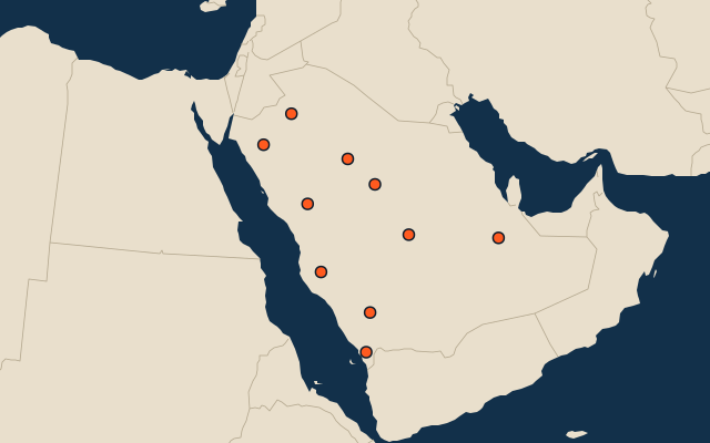
10 regions, each one drawn on a satellite globe. Name it when it lights up, find it when you are given its name, or type every one you can remember in Name all.
Free to start: a few quizzes a day cost nothing, and Geotcha Plus opens every quiz. What you miss comes back for review until it sticks.
The full list
About this quiz
Makkah is the largest of the 10 regions in this quiz, at 11.2 M; Al-Jowf is the smallest listed, at 665 k. The three largest hold 67% of the combined population of all 10.
What they are known for
- Makkah: Birthplace of Islam, with the Kaaba and Grand Mosque, the Hajj pilgrimage and the Red Sea port of Jeddah.
- Riyadh: Capital region at the desert's centre, with Kingdom Tower, Masmak Fort and Diriyah, ancestral seat of the Saud family.
- Eastern: Oil heartland on the Persian Gulf, with Dhahran's Aramco headquarters, Dammam, causeway to Bahrain and Al-Ahsa oasis.
- 'Asir: Southwestern highlands of terraced fields, misty Abha, Soudah peak, Red Sea escarpment and Tihama fortress villages.
- Al Madinah: Home of the Prophet's Mosque, a holy city of pilgrimage and Uhud mountain, with date farms and Hejaz railway.
- Jazan: Southwest Red Sea region with Farasan islands, coffee farms and Yemen border, with Fifa Mountains.
- Al-Qassim: Central region with date palm oases, the world's largest date festival and a historic Najd farming culture.
- Tabuk: Northwest region by the Gulf of Aqaba, with the Neom megacity project, Midian ruins and red sandstone mountains.
The regions
- 1Makkah11.2 M
- 2Riyadh7.8 M
- 3Eastern4.8 M
- 4'Asir2.9 M
- 5Al Madinah2.8 M
- 6Jazan2.1 M
- 7Al-Qassim1.4 M
- 8Tabuk1.2 M
- 9Ha'il669 k
- 10Al-Jowf665 k
On the map
All of Asia
More in Saudi Arabia
- 25 largest cities in Saudi Arabia
- Regions of Saudi Arabia
- 6 highest peaks in Saudi Arabia
- 10 largest islands in Saudi Arabia
- 8 best known World Heritage Sites in Saudi Arabia
- 10 largest cities in Saudi Arabia
- Cities ranked 26–50 in Saudi Arabia
- Regional capitals of Saudi Arabia
- Cities over 100,000 in Saudi Arabia
Other countries of Asia
- States of India
- 10 most populous states of India
- Districts of India
- 25 most populous districts of India
- Provinces of China
- 10 most populous provinces of China
- Prefectures of China
- 25 most populous prefectures of China
How the figures are measured
Population of each region: a 2025 estimate: the latest official figure (a census or an estimate, as each item names it) scaled with the rest of its country’s regions to the World Bank’s 2025 national total, so a country’s regions share one year. Each item names its source and year. Regions without a figure are left out.