GeotchaA geography quiz on a real globe
10 largest lakes in Telemark
10 lakes, each one drawn on a satellite globe. Name it when it lights up, find it when you are given its name, or type every one you can remember in Name all.
Free to start: a few quizzes a day cost nothing, and Geotcha Plus opens every quiz. What you miss comes back for review until it sticks.
The full list
About this quiz
Møsvatn is the largest of the 10 lakes in this quiz, at 79 km²; Flåvatn is the smallest listed, at 20 km². The three largest hold 47% of the combined area of all 10.
What they are known for
- Tinnsjå: Norwegian lake where a heavy-water ferry was sunk in 1944
The lakes
- 1Møsvatn79 km²
- 2Nisser76 km²
- 3Norsjø55 km²
- 4Tinnsjå52 km²
- 5Fyresvatnet50 km²
- 6Totak37 km²
- 7Gøystavatnet31 km²
- 8Bandak27 km²
- 9Farris21 km²
- 10Flåvatn20 km²
On the map
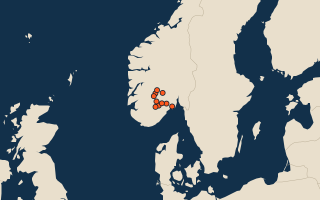
All of Norway
More in Telemark
Elsewhere in Norway
Norway, by kind
The whole world
How the figures are measured
Lakes by surface area in km². The Caspian Sea counts as a lake. Coastal lagoons do not, and a salt pan that is dry most years (Lake Eyre) is not ranked by size. A lake belongs to every country on its shores. Natural lakes only: reservoirs held back by a dam are left out. An item counts for every first-level unit (state, province, county) it touches: a lake or island by its outline, within about 1.5 km; a river by its course, when 10 km of it (3% of a shorter river) lies in or along the unit; a summit, a cape or anything without a shape by its point.