GeotchaA geography quiz on a real globe
Municipalities of Okinawa, Japan
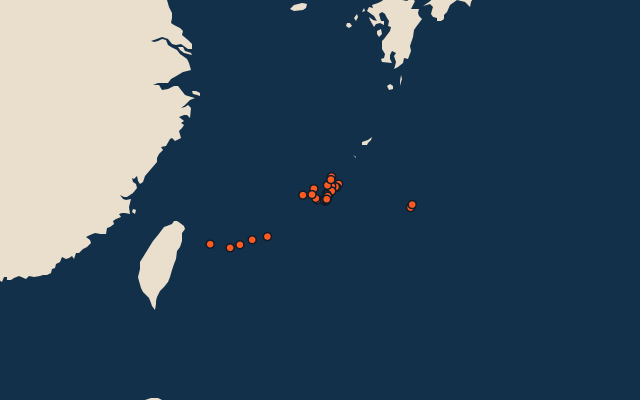
41 municipalities, each one drawn on a satellite globe. Name it when it lights up, find it when you are given its name, or type every one you can remember in Name all.
Free to start: a few quizzes a day cost nothing, and Geotcha Plus opens every quiz. What you miss comes back for review until it sticks.
The full list
About this quiz
Taketomi is the largest of the 41 municipalities in this quiz, at 334 km²; Tonaki is the smallest listed, at 4 km². The three largest hold 34% of the combined area of all 41.
The municipalities
- 1Taketomi334 km²
- 2Ishigaki229 km²
- 3Nago210 km²
- 4Miyakojima204 km²
- 5Kunigami195 km²
- 6Uruma87 km²
- 7Higashi82 km²
- 8Kumejima64 km²
- 9Ōgimi64 km²
- 10Motobu54 km²
- 11Onna51 km²
- 12Nanjō50 km²
- 13Okinawa50 km²
- 14Itoman47 km²
- 15Naha40 km²
- 16Nakijin40 km²
- 17Kin38 km²
- 18Yomitan35 km²
- 19Ginoza31 km²
- 20Minamidaitō31 km²
- 21Yonaguni29 km²
- 22Yaese27 km²
- 23Ie23 km²
- 24Iheya22 km²
- 25Tarama22 km²
- 26Ginowan20 km²
- 27Tokashiki19 km²
- 28Tomigusuku19 km²
- 29Urasoe19 km²
- 30Zamami17 km²
- 31Nishihara16 km²
- 32Izena15 km²
- 33Kadena15 km²
- 34Nakagusuku15 km²
- 35Chatan14 km²
- 36Kitadaitō13 km²
- 37Kitanakagusuku12 km²
- 38Haebaru11 km²
- 39Aguni8 km²
- 40Yonabaru5 km²
- 41Tonaki4 km²
On the map
All of Japan
More in Okinawa
Elsewhere in Japan
- Municipalities of Aichi
- Municipalities of Akita
- Municipalities of Aomori
- Municipalities of Chiba
- Municipalities of Ehime
- Municipalities of Fukui
- Municipalities of Fukuoka
- Municipalities of Fukushima
Japan, by kind
- 25 highest peaks in Japan
- 25 largest cities in Japan
- 9 largest lakes in Japan
- 25 longest rivers in Japan
How the figures are measured
Second-level units: the 1740 municipalities, within the 47 prefectures (the first level), which the region hint names.