GeotchaA geography quiz on a real globe
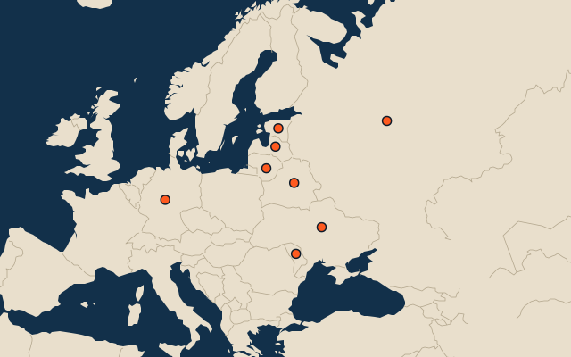
Countries with parts formerly held by Poland
8 countries, each one drawn on a satellite globe. Name it when it lights up, find it when you are given its name, tell its flag from three others, or type every one you can remember in Name all.
Free to play, with no account needed. What you miss comes back for review until it sticks.
The countries
- 1Russia17,075,400 km²
- 2Ukraine603,550 km²
- 3Germany357,588 km²
- 4Belarus207,597 km²
- 5Lithuania65,300 km²
- 6Latvia64,594 km²
- 7Estonia45,335 km²
- 8Moldova33,844 km²
Area in km²: standard reference totals including inland water, as in the Countries set. Poland (with the Polish–Lithuanian Commonwealth): places once under its rule and not now, from Wikidata’s dated country statements and colonial-empire membership, and the CIA World Factbook’s independence dates; military occupations of a few years are left out. A country counts when it, or any of its regions, dependencies, islands or cities, was held. Sources: Wikidata (CC0), Natural Earth 1:50m admin-0.
On the map
More in Poland
Similar quizzes
- Countries formerly held by France
- Countries with parts formerly held by France
- Countries formerly held by the Soviet Union
- Countries with parts formerly held by the Soviet Union
- Countries formerly held by the United Kingdom
- Countries with parts formerly held by the United Kingdom
- Countries with parts formerly held by Russia
- Countries with parts formerly held by the Ottoman Empire
- Countries with parts formerly held by Germany
- Countries with parts formerly held by Austria
- Countries of the world