GeotchaA geography quiz on a real globe
Countries of Europe in 1914
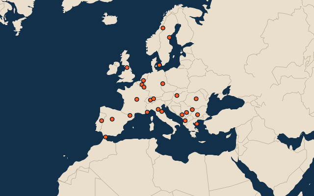
26 countries, each one drawn on a satellite globe. Name it when it lights up, find it when you are given its name, or type every one you can remember in Name all.
Free to play, with no account needed. What you miss comes back for review until it sticks.
The countries
- 1Ottoman Empire4,195,477 km²
- 2France2,858,289 km²
- 3Denmark2,297,637 km²
- 4Portugal1,396,277 km²
- 5Spain852,198 km²
- 6Austria-Hungary673,326 km²
- 7Kingdom of the Netherlands592,709 km²
- 8German Empire542,068 km²
- 9Sweden443,785 km²
- 10Norway378,246 km²
- 11Italy308,675 km²
- 12United Kingdom of Great Britain and Ireland308,048 km²
- 13Kingdom of Romania237,211 km²
- 14Kingdom of Greece167,589 km²
- 15Tsardom of Bulgaria160,833 km²
- 16Kingdom of Serbia85,886 km²
- 17Switzerland41,200 km²
- 18Belgium30,603 km²
- 19Principality of Albania29,210 km²
- 20Kingdom of Montenegro15,486 km²
- 21Luxembourg7,024 km²
- 22Andorra459 km²
- 23Liechtenstein153 km²
- 24San Marino66 km²
- 25Monaco17 km²
- 26Gibraltar6 km²
The map as it stood on 1 July 1914 (a year means its 1 July), with the names of the time. Sovereign states as they were then; British dominions count from the Statute of Westminster (1931), Egypt from 1922. Colonies, protectorates and mandates are not countries here: they have quizzes of their own. Area in km², measured on the largest of its outlines (simplified, clipped to land). Sources: OpenHistoricalMap contributors (CC0), Wikidata (CC0).
On the map
More in Europe
- 25 largest cities in Europe
- Countries of Europe
- 25 largest regions in Europe
- 25 largest lakes in Europe
- 25 longest rivers in Europe
- 25 highest peaks in Europe
- 25 largest islands in Europe
- 25 largest glaciers in Europe by area
- Flags of Europe
- Cities ranked 26–50 in Europe
Similar quizzes
- Countries formerly held by the Soviet Union
- Countries formerly held by France
- Countries with parts formerly held by France
- Countries formerly held by the United Kingdom
- Countries with parts formerly held by the United Kingdom
- Countries with parts formerly held by Russia
- Countries formerly held by the Ottoman Empire
- Countries with parts formerly held by the Ottoman Empire
- Countries with parts formerly held by Austria
- Countries with parts formerly held by Hungary
- Countries of the world