GeotchaA geography quiz on a real globe
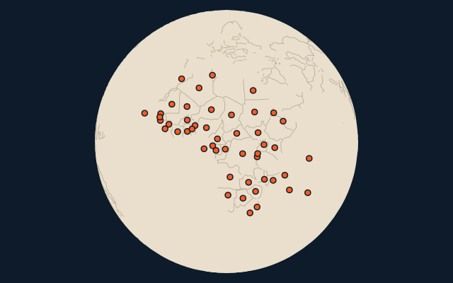
Countries of Africa by the state they became independent from
48 countries, each one drawn on a satellite globe. Name it when it lights up, find it when you are given its name, tell its flag from three others, or type every one you can remember in Name all.
Free to start: a few quizzes a day cost nothing, and Geotcha Plus opens every quiz. What you miss comes back for review until it sticks.
The full list
About this quiz
Algeria is the largest of the 48 countries in this quiz, at 2,381,741 km²; the Seychelles is the smallest listed, at 459 km². The three largest hold 27% of the combined area of all 48.
What they are known for
- Algeria: Largest country in Africa, with over 80 percent of it Sahara.
- Democratic Republic of the Congo: Former Belgian colony at the heart of Africa, home of okapis and mountain gorillas
- Sudan: More pyramids than its northern neighbour, built by the Nubian kings of Kush.
- Chad: Takes its name from a shrinking lake in the west, with the Sahara covering its north.
- Niger: Landlocked Sahel state, mostly desert, named for a great river that only crosses its corner.
- Angola: Portuguese-speaking oil producer with a detached northern exclave called Cabinda.
- Mali: Timbuktu, the fabled desert city, and the medieval empire of Mansa Musa.
- Mauritania: Home of the Richat Structure, the 'Eye of the Sahara', and some of the world's longest trains.
The countries
- 1Algeria2,381,741 km²
- 2Democratic Republic of the Congo2,344,858 km²
- 3Sudan1,886,068 km²
- 4Chad1,284,000 km²
- 5Niger1,267,000 km²
- 6Angola1,246,700 km²
- 7Mali1,240,192 km²
- 8Mauritania1,030,700 km²
- 9Egypt1,010,408 km²
- 10Nigeria923,768 km²
- 11Namibia825,615 km²
- 12Mozambique801,590 km²
- 13Zambia752,618 km²
- 14South Sudan644,329 km²
- 15Central African Republic622,984 km²
- 16Madagascar587,295 km²
- 17Botswana581,737 km²
- 18Kenya581,309 km²
- 19Cameroon475,442 km²
- 20Morocco446,550 km²
- 21Zimbabwe390,757 km²
- 22Republic of the Congo342,000 km²
- 23Côte d'Ivoire322,463 km²
- 24Burkina Faso274,200 km²
- 25Gabon267,667 km²
- 26Guinea245,857 km²
- 27Uganda241,038 km²
- 28Ghana238,535 km²
- 29Senegal196,722 km²
- 30Tunisia163,610 km²
- 31Malawi118,484 km²
- 32Eritrea117,600 km²
- 33Benin114,763 km²
- 34Sierra Leone71,740 km²
- 35Togo56,785 km²
- 36Guinea-Bissau36,125 km²
- 37Lesotho30,355 km²
- 38Equatorial Guinea28,051 km²
- 39Burundi27,834 km²
- 40Rwanda26,338 km²
- 41Djibouti23,200 km²
- 42Eswatini17,364 km²
- 43Gambia11,300 km²
- 44Cabo Verde4,033 km²
- 45Mauritius2,040 km²
- 46Comoros2,034 km²
- 47São Tomé and Príncipe1,001 km²
- 48Seychelles459 km²
On the map
More in Africa
- 25 largest cities in Africa
- Countries of Africa
- 25 largest regions in Africa
- 25 largest lakes in Africa
- 25 longest rivers in Africa
- 25 highest peaks in Africa
- 25 largest islands in Africa
- 25 best known World Heritage Sites in Africa
- Flags of Africa
- Cities ranked 26–50 in Africa
Similar quizzes
- Countries formerly held by the Soviet Union
- Countries formerly held by France
- Countries with parts formerly held by France
- Countries formerly held by the United Kingdom
- Countries with parts formerly held by the United Kingdom
- Countries with parts formerly held by Russia
- Countries formerly held by the Ottoman Empire
- Countries with parts formerly held by the Ottoman Empire
The whole world
How the figures are measured
Area in km²: standard reference totals including inland water, as in the Countries set. Independent from: the state the CIA World Factbook names for the country’s independence; countries that were never colonised or were formed by a union have none and are left out.