GeotchaA geography quiz on a real globe
Counties of eastern Norway
7 counties, each one drawn on a satellite globe. Name it when it lights up, find it when you are given its name, tell its flag from three others, or type every one you can remember in Name all.
Free to start: a few quizzes a day cost nothing, and Geotcha Plus opens every quiz. What you miss comes back for review until it sticks.
The full list
About this quiz
Innlandet is the largest of the 7 counties in this quiz, at 52,072 km²; Oslo is the smallest listed, at 454 km². Innlandet's area is 3.4 times Telemark's (15,298 km²). The three largest hold 87% of the combined area of all 7.
What they are known for
- Innlandet: Inland mountain region of Lillehammer's Olympics, Rondane parks, Norway's longest river Glomma and Jotunheimen.
- Telemark: Heddal stave church, Skien where Ibsen was born, and Morgedal, cradle of modern skiing.
- Buskerud: Kongsberg's silver mines, Hallingdal valley, Norefjell skiing and Drammen on the way to the capital.
- Akershus: Surrounds the capital to the east, with Gardermoen airport and Eidsvoll, where the 1814 constitution was written.
- Østfold: Southeastern county on the Swedish border with Fredrikstad's old fortress and the Iddefjord.
- Vestfold: Coastal county of Viking ship burial at Oseberg, Tønsberg and Sandefjord's whaling past.
The counties
- 1Innlandet52,072 km²
- 2Telemark15,298 km²
- 3Buskerud14,694 km²
- 4Akershus5,895 km²
- 5Østfold4,003 km²
- 6Vestfold2,168 km²
- 7Oslo454 km²
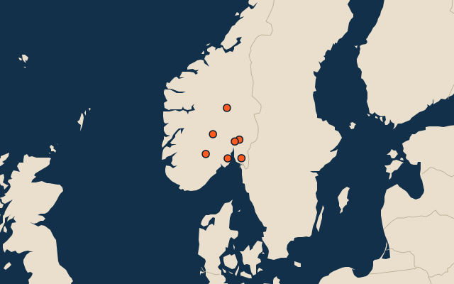
On the map
More in Eastern Norway
- 25 largest cities in eastern Norway
- 25 largest lakes in eastern Norway
- 8 longest rivers in eastern Norway
- 25 highest peaks in eastern Norway
- 7 largest islands in eastern Norway
How the figures are measured
The 7 counties of eastern Norway. Eastern Norway: Oslo, Akershus, Buskerud, Østfold, Innlandet, Vestfold and Telemark.