GeotchaA geography quiz on a real globe
8 most populous states and territories of Australia
8 states and territories, each one drawn on a satellite globe. Name it when it lights up, find it when you are given its name, tell its flag from three others, or type every one you can remember in Name all.
Free to start: a few quizzes a day cost nothing, and Geotcha Plus opens every quiz. What you miss comes back for review until it sticks.
The full list
About this quiz
New South Wales is the largest of the 8 states and territories in this quiz, at 8.6 M; Northern Territory is the smallest listed, at 265 k. The three largest hold 77% of the combined population of all 8.
What they are known for
- New South Wales: Sydney Opera House and Harbour Bridge, Bondi Beach, the Blue Mountains and Hunter Valley wine.
- Victoria: Great Ocean Road with the Twelve Apostles, Melbourne's coffee lanes and the gold rush at Ballarat.
- Queensland: Great Barrier Reef, Gold Coast surf, Daintree rainforest and Brisbane under tropical sunshine.
- Western Australia: Perth, Pilbara iron ore, the Kimberley, Ningaloo's whale sharks and Wave Rock across a vast desert-and-coast expanse.
- South Australia: Barossa wine, the Flinders Ranges, Kangaroo Island, Adelaide's festivals and underground opal town Coober Pedy.
- Tasmania: Island state across Bass Strait with devils, Cradle Mountain, Port Arthur convict ruins and MONA.
- Australian Capital Territory: Purpose-designed seat of government around an artificial lake, with Parliament House and the War Memorial.
- Northern Territory: Uluru, Kakadu wetlands, Darwin's saltwater crocodiles, Alice Springs and Aboriginal culture in the Red Centre.
The states and territories
- 1New South Wales8.6 M
- 2Victoria7 M
- 3Queensland5.7 M
- 4Western Australia3 M
- 5South Australia1.9 M
- 6Tasmania578 k
- 7Australian Capital Territory486 k
- 8Northern Territory265 k
On the map
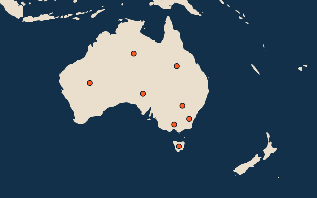
All of Oceania
More in Australia
- 25 largest cities in Australia
- States and territories of Australia
- 25 largest lakes in Australia
- 25 longest rivers in Australia
- 25 highest peaks in Australia
- 25 largest islands in Australia
- 21 best known World Heritage Sites in Australia
- Flags of the states and territories of Australia
- 10 largest cities in Australia
- 7 best known waterfalls in Australia
Other countries of Oceania
- Regions and the special island authority of New Zealand
- 10 most populous regions and the special island authority of New Zealand
- Provinces, the autonomous region and the district of Papua New Guinea
- 10 most populous provinces, the autonomous region and the district of Papua New Guinea
- States of Palau
- 10 most populous states of Palau
- Districts of Samoa
- 10 most populous districts of Samoa
How the figures are measured
Population of each region: a 2025 estimate: the latest official figure (a census or an estimate, as each item names it) scaled with the rest of its country’s regions to the World Bank’s 2025 national total, so a country’s regions share one year. Each item names its source and year. Regions without a figure are left out.