GeotchaA geography quiz on a real globe
25 wettest capitals in the world
25 capitals, each one drawn on a satellite globe. Name it when it lights up, find it when you are given its name, or type every one you can remember in Name all.
Free to start: a few quizzes a day cost nothing, and Geotcha Plus opens every quiz. What you miss comes back for review until it sticks.
The full list
About this quiz
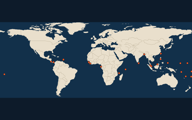
The quiz covers 25 capitals, from Palikir and Monrovia to Castries.
The capitals
- 1Palikir Micronesia4,956 mm
- 2Monrovia Liberia4,883 mm
- 3Ngerulmud Palau3,906 mm
- 4Conakry Guinea3,688 mm
- 5Bandar Seri Begawan Brunei3,619 mm
- 6Apia Samoa3,548 mm
- 7Majuro Marshall Islands3,538 mm
- 8San José Costa Rica3,402 mm
- 9Funafuti Tuvalu3,249 mm
- 10Freetown Sierra Leone3,037 mm
- 11Sri Jayawardenepura Kotte Sri Lanka3,022 mm
- 12Honiara Solomon Islands2,923 mm
- 13Victoria Seychelles2,847 mm
- 14Libreville Gabon2,781 mm
- 15Kuala Lumpur Malaysia2,768 mm
- 16Taipei Taiwan2,734 mm
- 17Singapore2,659 mm
- 18Suva Fiji2,638 mm
- 19Manila Philippines2,581 mm
- 20Port Vila Vanuatu2,304 mm
- 21Moroni Comoros2,287 mm
- 22Panama City Panama2,256 mm
- 23Kingstown Saint Vincent and the Grenadines2,203 mm
- 24Dhaka Bangladesh2,175 mm
- 25Castries Saint Lucia2,137 mm
On the map
More of the world
- 25 largest cities in the world
- 25 largest countries in the world
- 50 largest regions in the world
- 25 largest lakes in the world
- 25 longest rivers in the world
- 25 highest peaks in the world
- 25 largest islands in the world
- 25 longest fjords in the world
- Flags of the world
- 50 largest cities in the world
The whole world
How the figures are measured
Mean annual precipitation (rain and melted snow) in mm, 1991-2020, from TerraClimate: the figure of the 9 km grid cell nearest the city’s point. A cell knows the land, not the street, so a city high above its surroundings (La Paz, Quito) reads as the land around it, and a coast or an island takes the nearest land cell’s.