GeotchaA geography quiz on a real globe
25 largest cities in the St. Lawrence basin
25 cities, each one drawn on a satellite globe. Name it when it lights up, find it when you are given its name, tell its flag from three others, or type every one you can remember in Name all.
Free to start: a few quizzes a day cost nothing, and Geotcha Plus opens every quiz. What you miss comes back for review until it sticks.
The full list
About this quiz
Chicago is the largest of the 25 cities in this quiz, at 9.8 M; Kingston is the smallest listed, at 132 k. The three largest hold 61% of the combined population of all 25. Canada has 16 of the 25, in a list that spans two countries.
What they are known for
- Chicago: Includes Elgin, Naperville.
- Toronto: Includes Hamilton.
- Detroit: Includes Dearborn, Toledo, Warren, Windsor.
- Cleveland: Includes Akron.
- Milwaukee: Includes Waukesha.
- Buffalo: Includes Cheektowaga, St. Catharines.
The cities
- 1Chicago United States9.8 M
- 2Toronto Canada8.3 M
- 3Detroit United States5.9 M
- 4Montreal Canada4.7 M
- 5Cleveland United States3.1 M
- 6Milwaukee United States1.5 M
- 7Ottawa Canada1.5 M
- 8Buffalo United States1.4 M
- 9London Canada363 k
- 10Kitchener Canada348 k
- 11Oshawa Canada313 k
- 12Gatineau Canada298 k
- 13Fort Wayne United States264 k
- 14Rochester United States211 k
- 15Grand Rapids United States199 k
- 16Burlington Canada187 k
- 17Sherbrooke Canada181 k
- 18Greater Sudbury Canada166 k
- 19Barrie Canada148 k
- 20Syracuse United States145 k
- 21Trois-Rivières Canada144 k
- 22Guelph Canada144 k
- 23Cambridge Canada138 k
- 24Milton Canada133 k
- 25Kingston Canada132 k
On the map
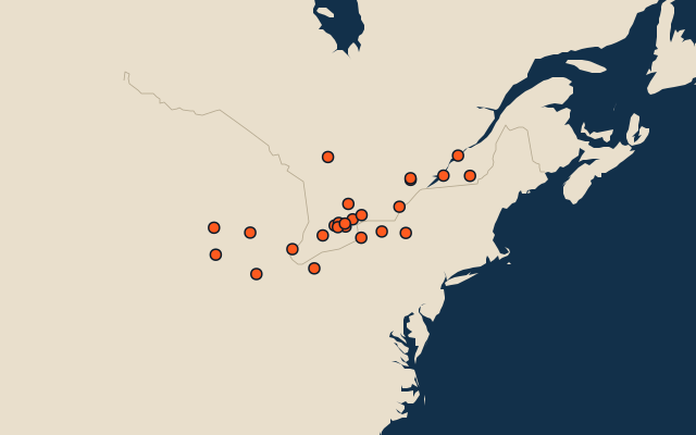
More in St. Lawrence basin
Similar quizzes
- 25 largest cities in the Amazon basin
- 25 largest cities in the Congo basin
- 25 largest cities in the Mississippi basin
- 25 largest cities in the Ob basin
- 25 largest cities in the Río de la Plata basin
- 25 largest cities in the Nile basin
- 25 largest cities in the Yenisei basin
- 12 largest cities in the Lena basin
The whole world
How the figures are measured
Population of the metro area: the city and the places continuously built up around it, as Thomas Brinkhoff’s Major Agglomerations of the World (citypopulation.de) counts them from censuses projected to 1 January 2026, the list most rankings use. It covers every agglomeration of 1 million or more; below that, a city ranks by its urban centre in the United Nations’ World Urbanization Prospects 2025 at 1 January 2026 (every city of 300,000 or more and every capital, counted by the Degree of Urbanisation on a 1 km grid), and a smaller city by its city-proper figure. Each source agglomeration is counted once: its main city and named core cities are accepted answers for the same entry. The included core cities are listed on its card. These agglomerations are not official US metropolitan statistical areas. Cities of the polycentric regions excluded from this source list still rank by their own figures. The St. Lawrence basin: what lies inside the river basin’s outline, by each item’s point (a lake’s centre, a river’s mouth, a summit).