GeotchaA geography quiz on a real globe
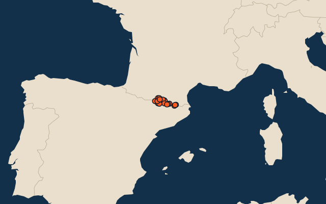
25 highest peaks in Catalonia
25 peaks, each one drawn on a satellite globe. Name it when it lights up, find it when you are given its name, or type every one you can remember in Name all.
Free to play, with no account needed. What you miss comes back for review until it sticks.
The peaks
- 1Pic de Sotllo3,073 m
- 2Comaloforno3,029 m
- 3Punta Alta de Comalesbienes3,014 m
- 4Tuc de Molières3,010 m
- 5Pic de Peguera2,983 m
- 6Gran Tuc de Colomers2,933 m
- 7Pic de Médécourbe2,915 m
- 8Puigpedrós2,915 m
- 9Puigmal2,910 m
- 10Monteixo2,905 m
- 11Pic de la Portelleta2,905 m
- 12Pica Roja2,903 m
- 13Pics de Bassiero2,903 m
- 14Gran Pic del Pessó2,894 m
- 15Montsent de Pallars2,883 m
- 16Tuc de Maubèrme2,882 m
- 17Bastiments2,881 m
- 18Cim del Mont-roig2,864 m
- 19Pic de Noufonts2,861 m
- 20Pic de Certascan2,853 m
- 21Montardo2,833 m
- 22Tuc de Barlonguèra2,802 m
- 23Pic de Salòria2,789 m
- 24Pico de Moredo2,766 m
- 25Monturull2,760 m
Summit elevation above sea level in metres: the Famous Peaks and Famous Volcanoes sets’ figure for their items, else Wikidata’s (P2044). Notable mountains and volcanoes from Wikidata: those with a prominence of 300 m or more, those 1,000 m or higher with articles in 8 or more Wikipedia editions, well-known volcanoes, and every country’s highest point (at most 400 a country), with every item of the Famous Peaks and Famous Volcanoes sets. Countries are Wikidata’s: both for a summit on a border. An item counts for every first-level unit (state, province, county) it touches: a lake or island by its outline, a river by its course, within about 1.5 km; a summit, a cape or anything without a shape by its point.
On the map
More in Catalonia
Similar quizzes
- 10 highest peaks in Badakhshan
- 6 highest peaks in Gjirokastër
- 10 highest peaks in Kukës
- 15 highest peaks in Catamarca
- 9 highest peaks in Mendoza
- 6 highest peaks in Neuquén
- 7 highest peaks in Santa Cruz, Argentina
- 25 highest peaks in Carinthia
- 21 highest peaks in Lower Austria
- 14 highest peaks in Upper Austria
- Famous peaks