GeotchaA geography quiz on a real globe
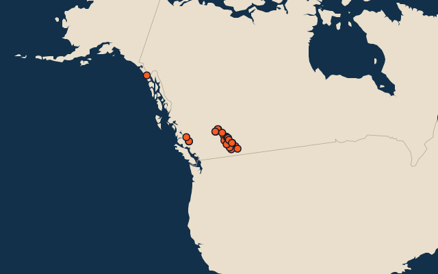
25 highest peaks in British Columbia
25 peaks, each one drawn on a satellite globe. Name it when it lights up, find it when you are given its name, or type every one you can remember in Name all.
Free to play, with no account needed. What you miss comes back for review until it sticks.
The peaks
- 1Mount Quincy Adams4,150 m
- 2Mount Waddington4,019 m
- 3Mount Robson3,954 m
- 4Mount Tiedemann3,838 m
- 5Mount Columbia3,747 m
- 6Mount Clemenceau3,664 m
- 7Mount Assiniboine3,618 m
- 8Mount Goodsir3,567 m
- 9Monarch Mountain3,555 m
- 10Mount Sir Sandford3,519 m
- 11Mount Sir Wilfrid Laurier3,516 m
- 12Mount Bryce3,507 m
- 13Ernest Peak3,498 m
- 14Mount Lyell (Canada)3,498 m
- 15Mount Farnham3,493 m
- 16Mount Hungabee3,492 m
- 17Mount Joffre3,450 m
- 18Deltaform Mountain3,424 m
- 19Howser Spire3,412 m
- 20Whitehorn Mountain3,399 m
- 21Mount Sir John Abbott3,398 m
- 22Mount Dawson3,377 m
- 23Mount Barnard3,340 m
- 24Simon Peak3,322 m
- 25Mount Biddle3,320 m
Summit elevation above sea level in metres: the Famous Peaks and Famous Volcanoes sets’ figure for their items, else Wikidata’s (P2044). Notable mountains and volcanoes from Wikidata: those with a prominence of 300 m or more, those 1,000 m or higher with articles in 8 or more Wikipedia editions, well-known volcanoes, and every country’s highest point (at most 400 a country), with every item of the Famous Peaks and Famous Volcanoes sets. Countries are Wikidata’s: both for a summit on a border. An item counts for every first-level unit (state, province, county) it touches: a lake or island by its outline, a river by its course, within about 1.5 km; a summit, a cape or anything without a shape by its point.
On the map
More in British Columbia
- 8 largest cities in British Columbia
- 25 largest lakes in British Columbia
- 25 longest rivers in British Columbia
- 25 largest islands in British Columbia