GeotchaA geography quiz on a real globe
25 driest capitals in the world
25 capitals, each one drawn on a satellite globe. Name it when it lights up, find it when you are given its name, tell its flag from three others, or type every one you can remember in Name all.
Free to start: a few quizzes a day cost nothing, and Geotcha Plus opens every quiz. What you miss comes back for review until it sticks.
The full list
About this quiz
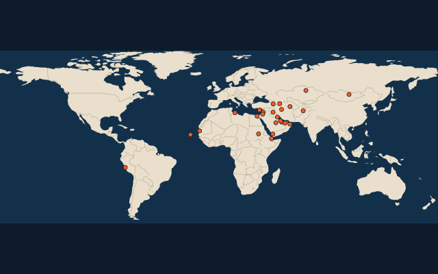
The quiz covers 25 capitals, from Lima and Cairo to Nicosia.
The capitals
- 1Lima Peru20 mm
- 2Cairo Egypt23 mm
- 3Abu Dhabi United Arab Emirates47 mm
- 4Doha Qatar79 mm
- 5Manama Bahrain89 mm
- 6Nouakchott Mauritania103 mm
- 7Khartoum Sudan105 mm
- 8Djibouti120 mm
- 9Muscat Oman120 mm
- 10Kuwait City Kuwait123 mm
- 11Riyadh Saudi Arabia133 mm
- 12Baghdad Iraq160 mm
- 13Ulaanbaatar Mongolia223 mm
- 14Praia Cabo Verde224 mm
- 15Ashgabat Turkmenistan228 mm
- 16Tehran Iran240 mm
- 17Sanaa Yemen246 mm
- 18Baku Azerbaijan247 mm
- 19Tripoli Libya288 mm
- 20Astana Kazakhstan290 mm
- 21Damascus Syria299 mm
- 22Amman Jordan303 mm
- 23Kabul Afghanistan314 mm
- 24Yerevan Armenia314 mm
- 25Nicosia Cyprus360 mm
On the map
More of the world
- 25 largest cities in the world
- 25 largest countries in the world
- 50 largest regions in the world
- 25 largest lakes in the world
- 25 longest rivers in the world
- 25 highest peaks in the world
- 25 largest islands in the world
- 25 longest fjords in the world
- Flags of the world
- 50 largest cities in the world
The whole world
How the figures are measured
Mean annual precipitation (rain and melted snow) in mm, 1991-2020, from TerraClimate: the figure of the 9 km grid cell nearest the city’s point. A cell knows the land, not the street, so a city high above its surroundings (La Paz, Quito) reads as the land around it, and a coast or an island takes the nearest land cell’s.