GeotchaA geography quiz on a real globe
25 countries in the world with the highest share of temperate grassland
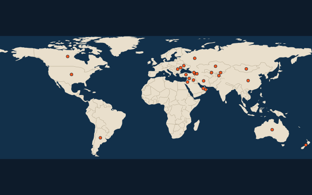
25 countries, each one drawn on a satellite globe. Name it when it lights up, find it when you are given its name, tell its flag from three others, or type every one you can remember in Name all.
Free to start: a few quizzes a day cost nothing, and Geotcha Plus opens every quiz. What you miss comes back for review until it sticks.
The full list
About this quiz
The quiz covers 25 countries, from Argentina and Kyrgyzstan to Iran.
What they are known for
- Argentina: The world’s highest share of temperate grassland
- Kyrgyzstan: Mountain nomads sleep in yurts, and its great alpine lake never freezes despite the altitude.
- Armenia: First country to make Christianity its state religion, in the year 301.
- Tajikistan: The Pamir Highway crosses its 'Roof of the World' mountains, beside its southern neighbour.
- Syria: Palmyra's desert ruins, and Damascus and Aleppo rank among the oldest inhabited cities.
- Ukraine: Its flag shows blue sky over a wheat field, and Chernobyl lies in its north.
- Kazakhstan: Baikonur, where Sputnik and Gagarin were launched, lies on its steppe, and the Aral Sea shrinks on its edge.
- Mongolia: Birthplace of Genghis Khan, where nomads live in round felt gers on the steppe.
The countries
- 1Argentina56.6%
- 2Kyrgyzstan49.3%
- 3Armenia48.2%
- 4Tajikistan46.7%
- 5Syria43.4%
- 6Ukraine41.9%
- 7Kazakhstan40.2%
- 8Mongolia38.7%
- 9Moldova27.3%
- 10United States26.8%
- 11Uzbekistan24%
- 12Jordan19.2%
- 13New Zealand19.2%
- 14Oman14.5%
- 15Turkey13.5%
- 16Romania10.2%
- 17Russia8.9%
- 18Iraq8.7%
- 19Australia6.9%
- 20China6.8%
- 21Georgia6.5%
- 22Azerbaijan5.9%
- 23Canada4.8%
- 24United Arab Emirates4.7%
- 25Iran3.9%
On the map
More of the world
- 25 largest cities in the world
- 25 largest countries in the world
- 50 largest regions in the world
- 25 largest lakes in the world
- 25 longest rivers in the world
- 25 highest peaks in the world
- 25 largest islands in the world
- 25 longest fjords in the world
- Flags of the world
- 50 largest cities in the world
The whole world
How the figures are measured
The share of the country’s land in the temperate grasslands, savannas and shrublands biome: the steppes of Eurasia, the prairies and the pampas, in %: the RESOLVE Ecoregions 2017 outlines (Dinerstein et al. 2017) over the country’s outline, measured by area. Glaciers count as land but in no biome; the outlines are simplified, so a small island country’s share is rough. Each item names its year; a country without a recent figure is left out.