GeotchaA geography quiz on a real globe
25 countries in the world with the highest share of flooded grassland
25 countries, each one drawn on a satellite globe. Name it when it lights up, find it when you are given its name, tell its flag from three others, or type every one you can remember in Name all.
Free to start: a few quizzes a day cost nothing, and Geotcha Plus opens every quiz. What you miss comes back for review until it sticks.
The full list
About this quiz
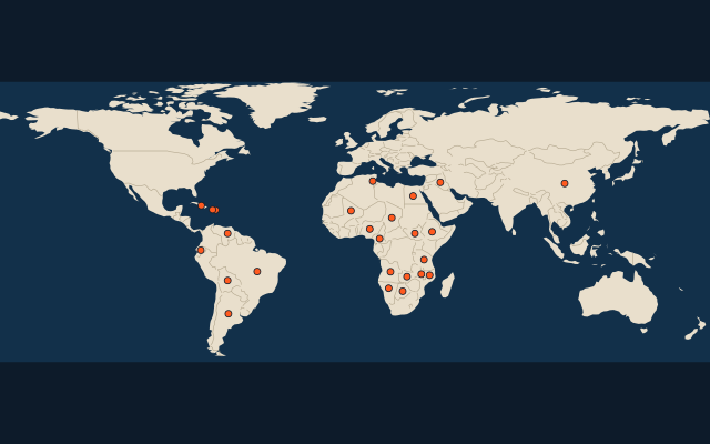
The quiz covers 25 countries, from South Sudan and Zambia to Venezuela.
What they are known for
- South Sudan: The world’s highest share of flooded grassland
- Zambia: Shares thundering Victoria Falls with its southern neighbour, and digs huge copper mines.
- Egypt: The pyramids of Giza, the Sphinx and the Suez Canal.
- Tunisia: Hannibal's Carthage stood on its coast, and Tatooine in Star Wars was filmed in its desert.
- Botswana: Mostly Kalahari desert, with a delta where a river vanishes into the sand and many elephants.
- Iraq: Cradle of ancient Babylon and Sumer, where cuneiform writing began.
- Cuba: Vintage American cars cruise Havana, and hand-rolled cigars are famous.
- Angola: Portuguese-speaking oil producer with a detached northern exclave called Cabinda.
The countries
- 1South Sudan28%
- 2Zambia10.7%
- 3Egypt7%
- 4Tunisia6.8%
- 5Botswana6.7%
- 6Iraq6.5%
- 7Cuba4.8%
- 8Angola4.5%
- 9Tanzania4%
- 10Mali3.7%
- 11Bolivia2.9%
- 12Malawi2.6%
- 13Mozambique2.6%
- 14Argentina2.3%
- 15Brazil1.6%
- 16Namibia1.4%
- 17Ecuador1.2%
- 18Chad1.1%
- 19China1.1%
- 20Cameroon1%
- 21Nigeria1%
- 22Ethiopia0.9%
- 23Dominican Republic0.8%
- 24Haiti0.7%
- 25Venezuela0.7%
On the map
More of the world
- 25 largest cities in the world
- 25 largest countries in the world
- 50 largest regions in the world
- 25 largest lakes in the world
- 25 longest rivers in the world
- 25 highest peaks in the world
- 25 largest islands in the world
- 25 longest fjords in the world
- Flags of the world
- 50 largest cities in the world
The whole world
How the figures are measured
The share of the country’s land in the flooded grasslands and savannas biome: the Sudd, the Okavango, the Pantanal, the Nile delta, the Everglades, in %: the RESOLVE Ecoregions 2017 outlines (Dinerstein et al. 2017) over the country’s outline, measured by area. Glaciers count as land but in no biome; the outlines are simplified, so a small island country’s share is rough. Each item names its year; a country without a recent figure is left out.