GeotchaA geography quiz on a real globe
25 countries in the world with the highest share of arable land
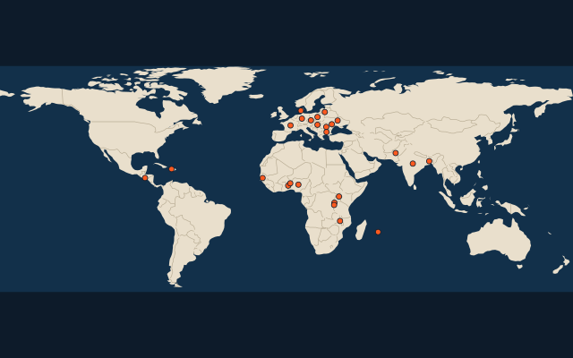
25 countries, each one drawn on a satellite globe. Name it when it lights up, find it when you are given its name, tell its flag from three others, or type every one you can remember in Name all.
Free to start: a few quizzes a day cost nothing, and Geotcha Plus opens every quiz. What you miss comes back for review until it sticks.
The full list
About this quiz
The quiz covers 25 countries, from Bangladesh and Denmark to France.
What they are known for
- Bangladesh: The world’s highest share of arable land
- Denmark: Home of LEGO, Hamlet's castle at Elsinore and a Little Mermaid statue.
- Gambia: A sliver of a country on both banks of a river, almost entirely surrounded by its larger neighbour.
- Ukraine: Its flag shows blue sky over a wheat field, and Chernobyl lies in its north.
- Moldova: Huge underground wine cellars at Mileștii Mici hold millions of bottles.
- India: Taj Mahal, Bollywood and cricket-mad crowds of well over a billion people.
- Rwanda: Land of a thousand hills, where mountain gorillas live in the Virunga volcanoes.
- Togo: A narrow West African strip whose capital, Lomé, sits right on the western border.
The countries
- 1Bangladesh60.5%
- 2Denmark58.9%
- 3Gambia58.1%
- 4Ukraine56.8%
- 5Moldova56.4%
- 6India51.7%
- 7Rwanda48.9%
- 8Togo48.7%
- 9Hungary45.2%
- 10Burundi43.7%
- 11Uganda43.6%
- 12Malawi42.4%
- 13Nigeria40.8%
- 14Pakistan39.8%
- 15Lithuania36.7%
- 16Poland36.6%
- 17Haiti36.5%
- 18Romania36.4%
- 19Mauritius35.3%
- 20El Salvador34.8%
- 21Germany33.4%
- 22Czechia32.7%
- 23Benin32.3%
- 24Bulgaria32.2%
- 25France31.3%
On the map
More of the world
- 25 largest cities in the world
- 25 largest countries in the world
- 50 largest regions in the world
- 25 largest lakes in the world
- 25 longest rivers in the world
- 25 highest peaks in the world
- 25 largest islands in the world
- 25 longest fjords in the world
- Flags of the world
- 50 largest cities in the world
The whole world
How the figures are measured
Arable land as a share of the land area, in %: land under temporary crops, temporary meadows, market gardens and short fallow; orchards and permanent pasture are not arable (World Bank WDI AG.LND.ARBL.ZS, from FAO, 2024). Each item names its year; a country without a recent figure is left out.