GeotchaA geography quiz on a real globe
12 highest peaks in Aquitaine
12 peaks, each one drawn on a satellite globe. Name it when it lights up, find it when you are given its name, or type every one you can remember in Name all.
Free to play, with no account needed. What you miss comes back for review until it sticks.
The peaks
- 1Pic de Ger2,613 m
- 2Pic d'Anie2,507 m
- 3Mesa de los Tres Reyes2,446 m
- 4Pic d'Orhy2,017 m
- 5le Layens1,625 m
- 6Mount Okabe1,466 m
- 7Iparla1,049 m
- 8Artzamendi931 m
- 9Larrun905 m
- 10Mount Baigura897 m
- 11La Madeleine795 m
- 12Arradoi660 m
Summit elevation above sea level in metres: the Famous Peaks and Famous Volcanoes sets’ figure for their items, else Wikidata’s (P2044). Notable mountains and volcanoes from Wikidata: those with a prominence of 300 m or more, those 1,000 m or higher with articles in 8 or more Wikipedia editions, well-known volcanoes, and every country’s highest point (at most 400 a country), with every item of the Famous Peaks and Famous Volcanoes sets. Countries are Wikidata’s: both for a summit on a border. Aquitaine: what lies inside the region’s outline, by each item’s point (a lake’s centre, a river’s mouth, a summit).
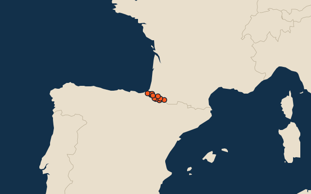
On the map
More in Aquitaine
Similar quizzes
- 25 highest peaks in the Pacific Islands
- 25 highest peaks in the Malay Archipelago
- 25 highest peaks in Melanesia
- 25 highest peaks in the British Isles
- 25 highest peaks in the Sunda Islands
- 25 highest peaks in Polynesia
- 11 highest peaks in the Arctic Archipelago
- 25 highest peaks in the Greater Sunda Islands
- 25 highest peaks in the West Indies
- 17 highest peaks in the Hebrides
- Famous peaks